Fremont County
Spacious Acreage Minutes from Canon City
JMDJR100 Canon City, CO 81212


Description
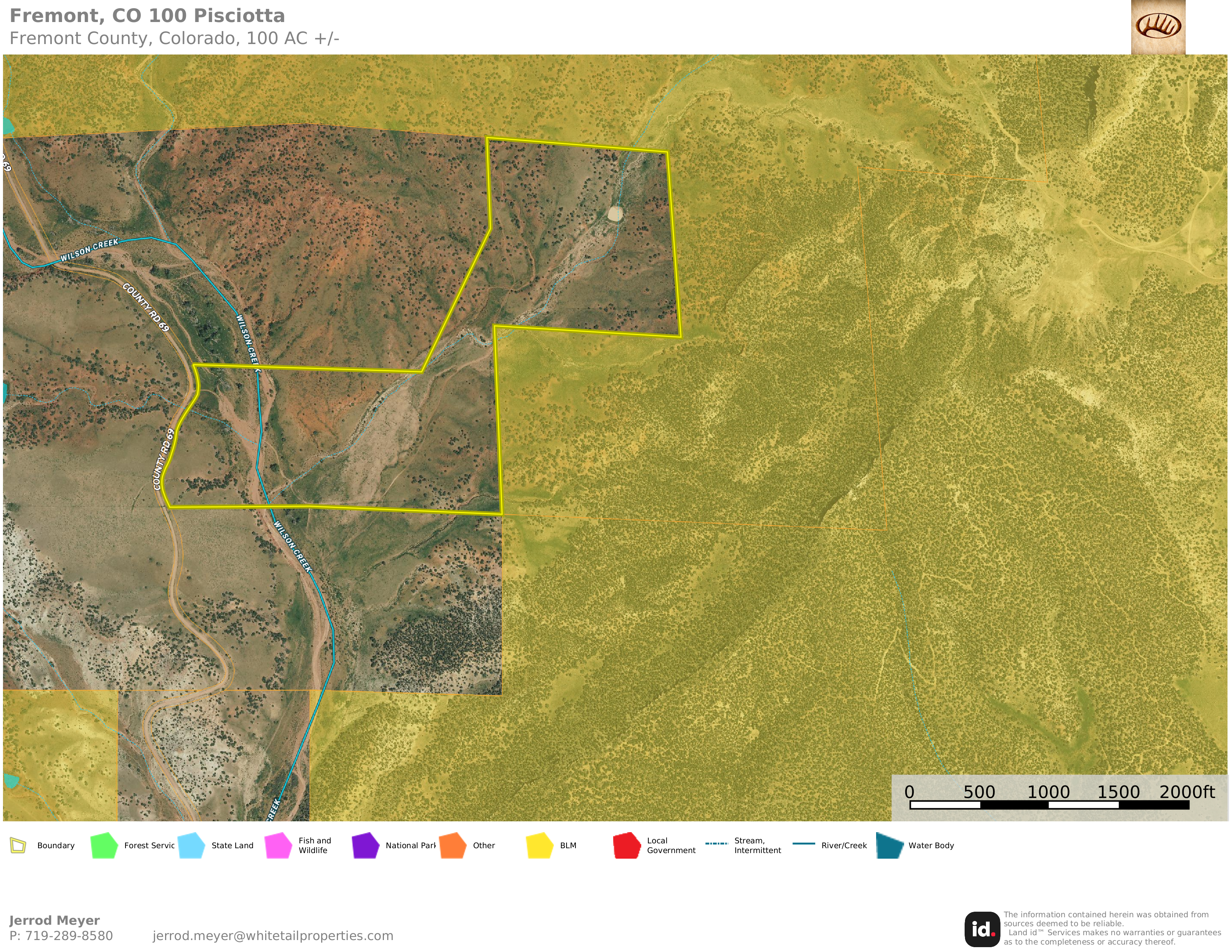
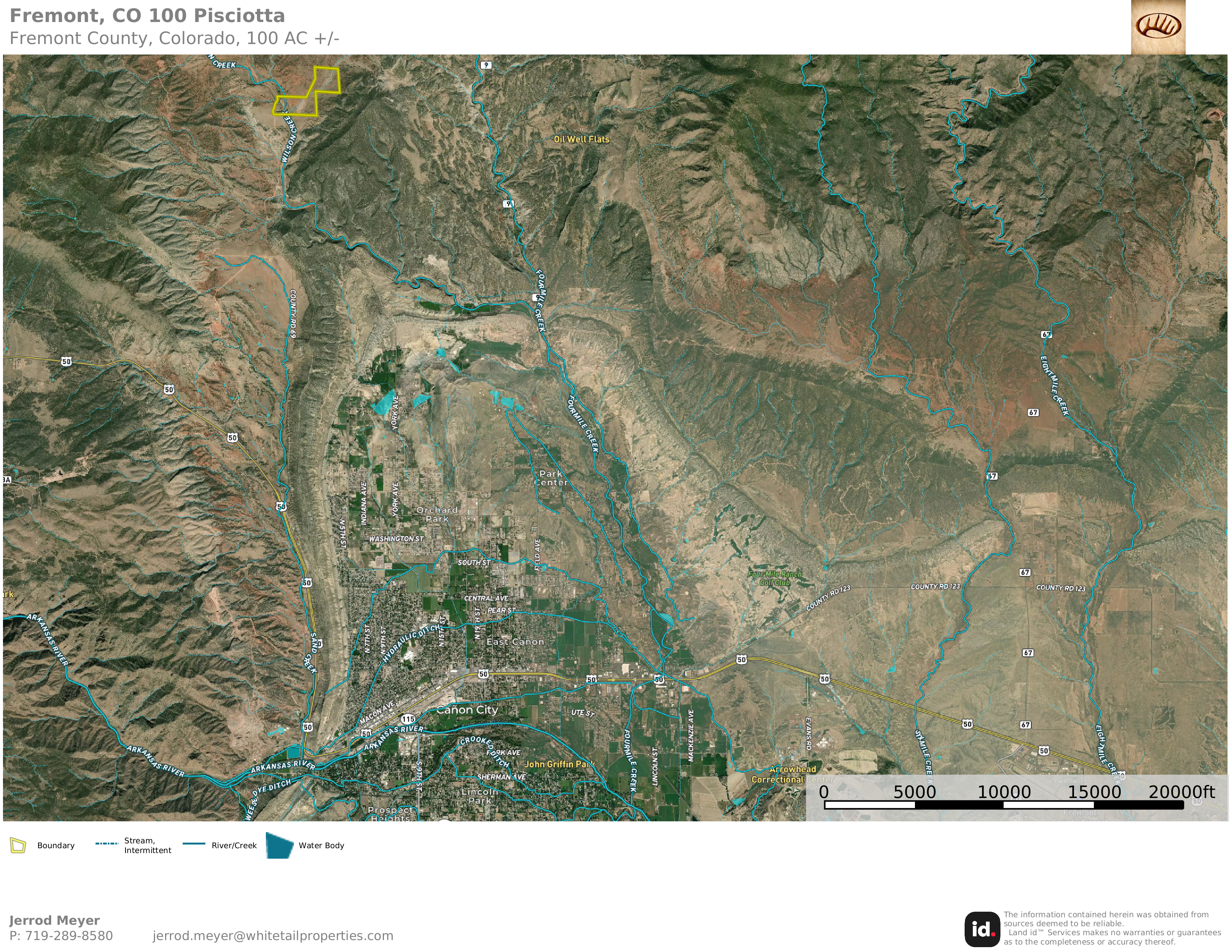
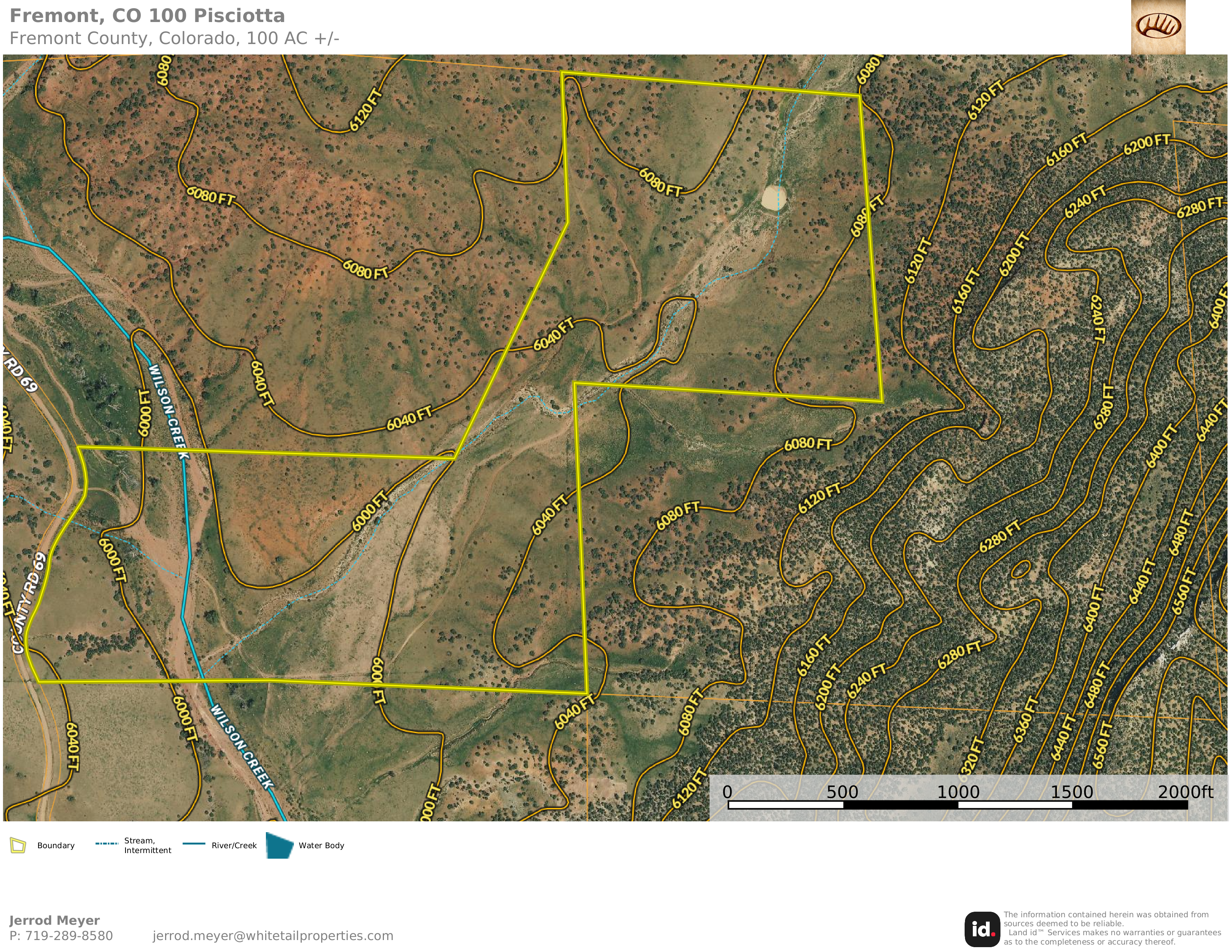
Great opportunity to own this spacious acreage bordering public BLM ground! Just minutes from Canon City, this property features County Road 69 frontage, mostly fenced, power to multiple points, a pond, and large arroyo! Choose from a multitude of building or camping sites with great elevated views of the surrounding mountain ridges. Pine, cottonwood, and native grasses draw in the local wildlife species including deer, turkey, bear, elk and more. Utilize the public lands bordering 3 sides to expand your adventure opportunities to thousands of acres! Located in Colorado Hunting Unit GMU #581, over-the-counter archery and 2nd/3rd season rifle elk tags are available. Nearby water wells depths range from 38-260 feet deep at comparable elevations. Maintained county road (gravel) frontage along the western boundary, as well as an improved driveway/road system with culverts across the arroyo to multiple building sites give you a great and easy head start for whatever your dream may be! Great option for building a home, camping, or recreational use adjacent to thousands of acres of BLM. Contact Whitetail Properties Accredited Land Specialist Jerrod Meyer for more information!
Summary
Address
Land Type
Property Type
Land and Farm Property Types
Road Frontage
Road Surface
Fencing
Improvements/Features
Activities on Property
Roads
Nearby Features
Waterfront
Wild Game
Details
- County Road 69 frontage (gravel)
- Power available along southern border and through middle of property
- Improved driveway and road system with new culverts
- Arroyo, ponds, and very usable terrain
- Multiple elevated building/camping sites
- Bordered on 3 sides by thousands of acres of public BLM Land
- Located in GMU #581; OTC archery and 2nd/3rd season rifle elk tags
- Minutes to Canon City and full amenities
- Local wells depths from 38-260 feet
- No active HOA/POA fees or covenants
- No owner financing available
- Check out the interactive map for 360 degree panoramic aerials
Area Links
Other
Coordinates
Annual Taxes
Sold Property
For more information or to see additional properties currently for sale see Jerrod Meyer's listings.