Perry County
Recreational Tract Adjoining Hoosier National Forest with a Unique History In Indiana
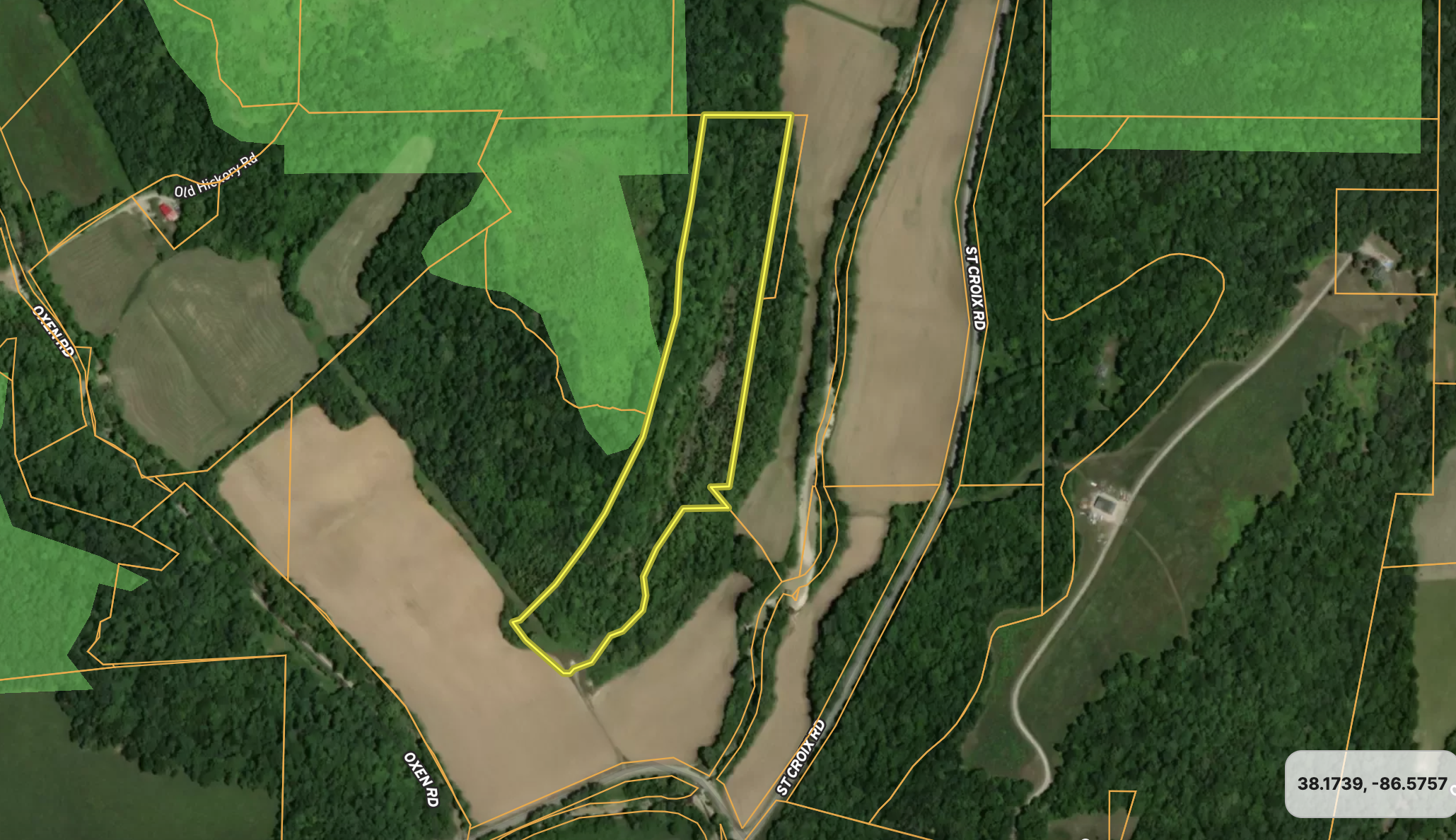
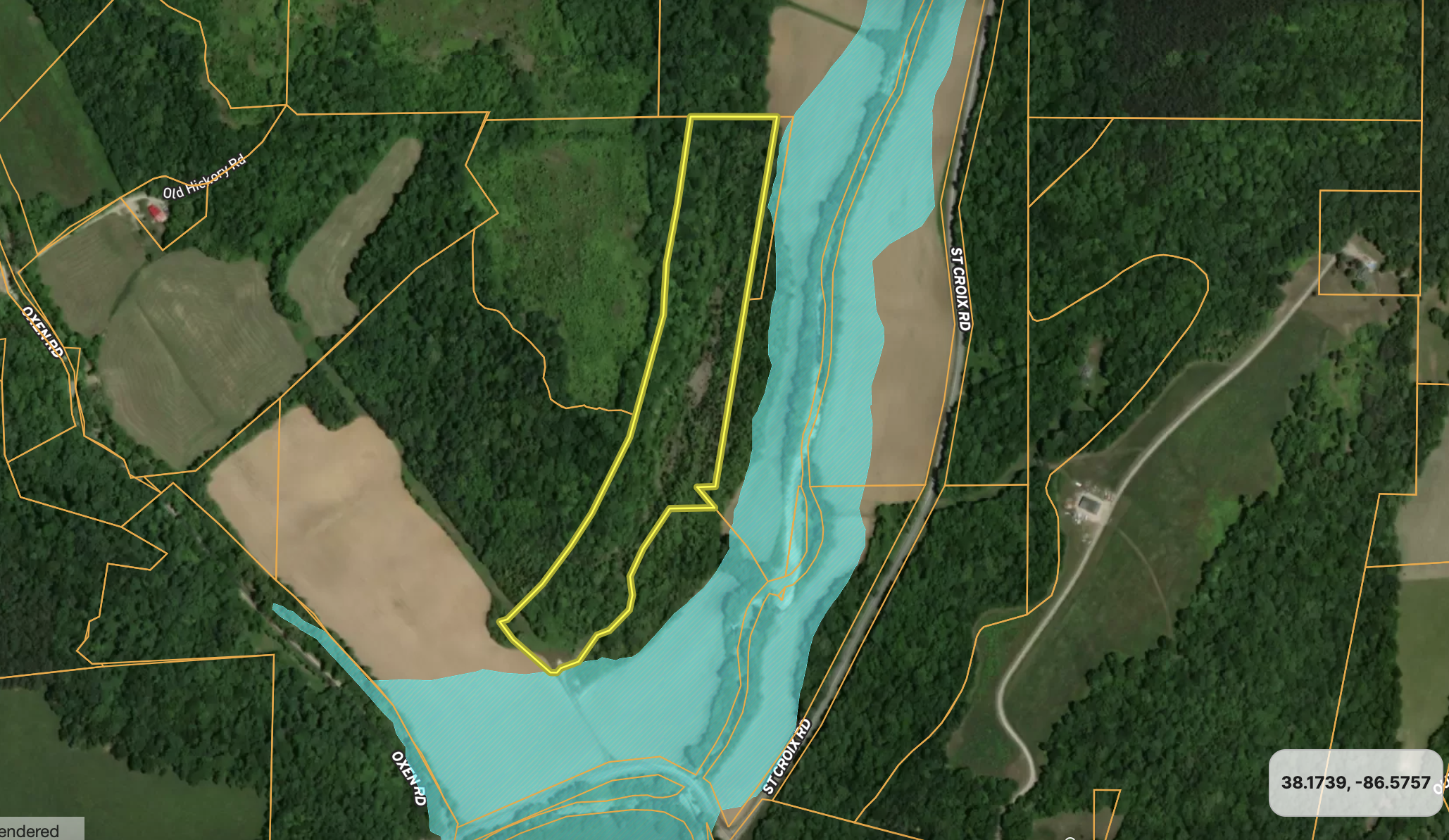
off St. Croix Rd, Lot#WP001 Saint Croix, IN 47576


Description
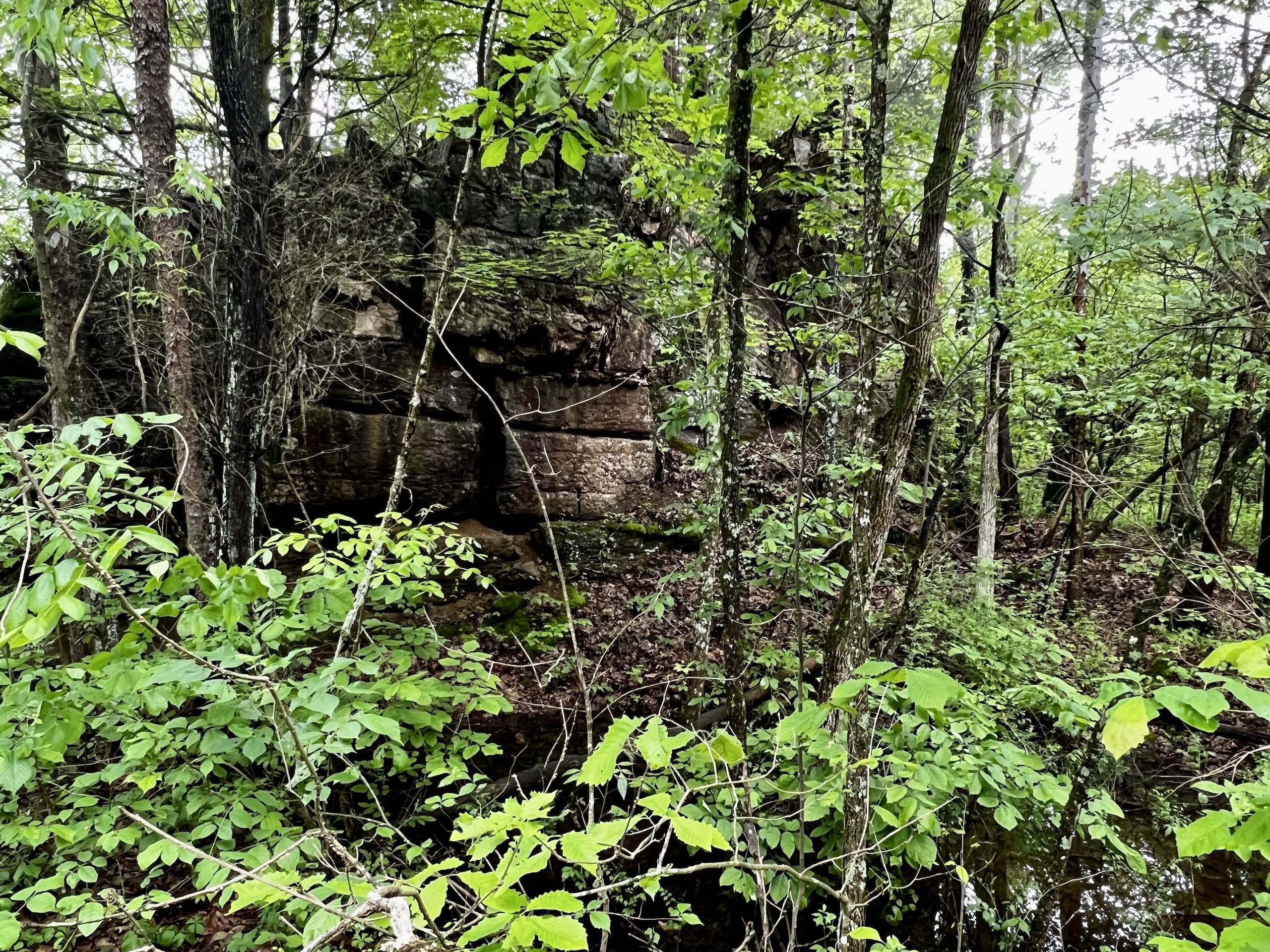
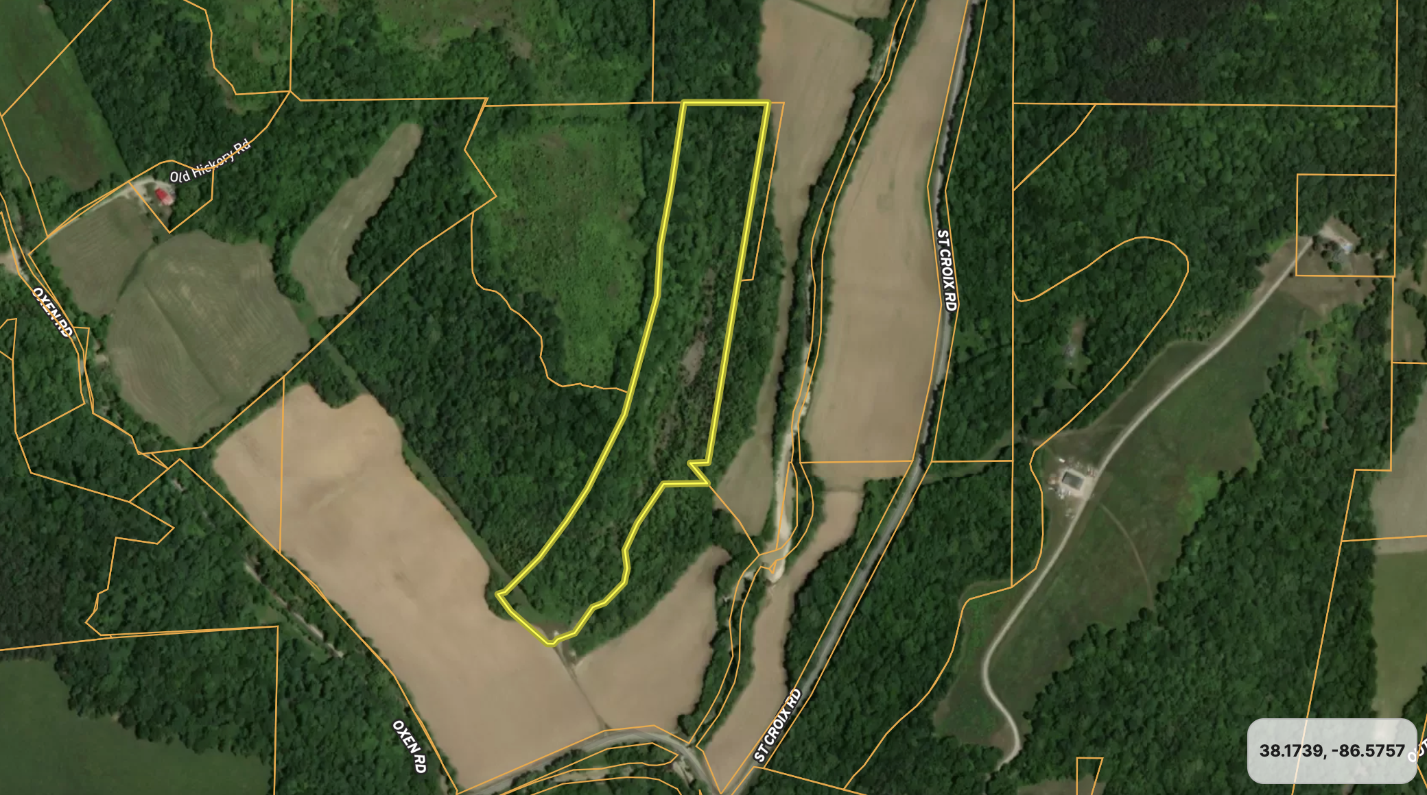
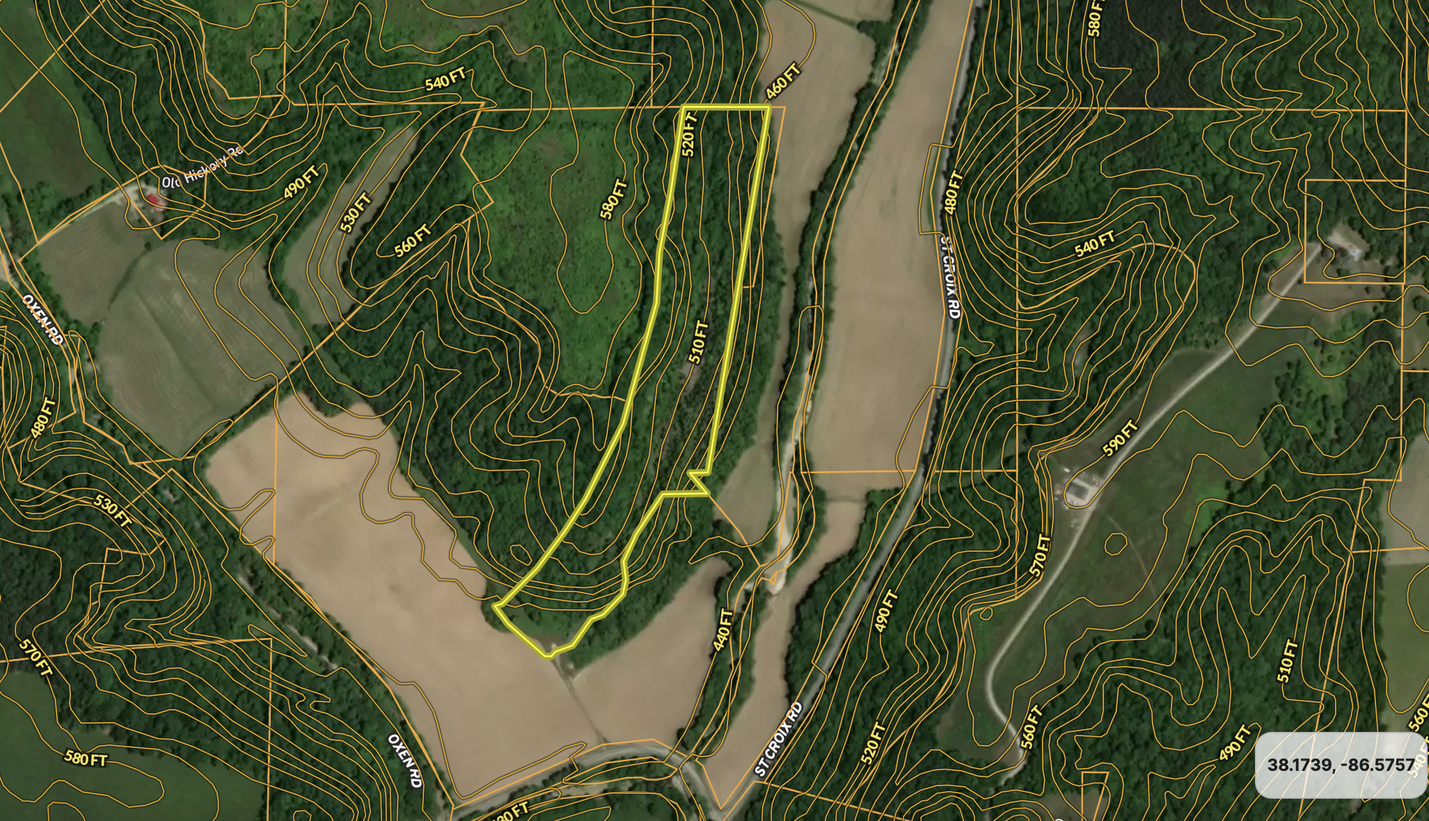
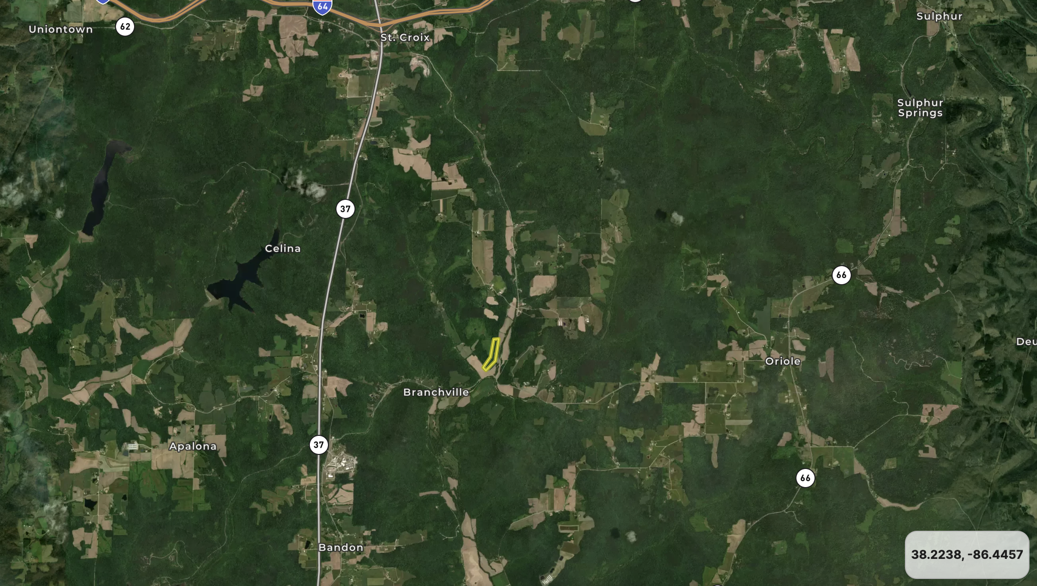
This property dates back to 1942, when a once functional limestone mine was abandoned. The history in the area at the time was rich with talk of abundant minerals, oil and fossils. As time changes and nature evolved, the old quarry has just over 80 years of growth and is full of life. The property is best described as a U-shaped wood valley. The West side's face in the valley is around 50 to 60 feet in height, while the East side is less drastic at around 20. Walking through the center of the valley, you will notice areas with year-round running water, wet-season waterfalls, and a nice hard rock shelf located almost in the center of the property. A notable number of cedars are scattered up and down the path, and you can tell bucks cruise the trail by all the rubs noticed. The property is situated around many crop fields, with deer funneling in them heavily to feed as the fall months approach. If that's not enough, this tract adjoins a locked piece of Hoosier National Forest with only touching landowners able to access. The area where this is located is known for producing great bucks; with these attributes, you can tell why. The current owner states it's a great place to find Morels in the spring if you like searching for them. Lastly, it's notable to mention a flat possible cabin pad or camper site is located as soon as you step onto the property from the recorded easement for your access. Power and water are located about 100 yards away and could also be possibly utilized.
Summary
Address
Land Type
Property Type
Land and Farm Property Types
Road Surface
Land Details
Improvements/Features
Activities on Property
Roads
Nearby Features
Fishing
Minerals
Wild Game
Details
- Adjoins Hoosier National Forest
- Great hunting
- Camping/cabin pad at front
- Fossils in rock deposits
- Year round running water
- Morels in the spring
Other
Utilities
Coordinates
Annual Taxes
Sold Property
For more information or to see additional properties currently for sale see Kris Christianson's listings.