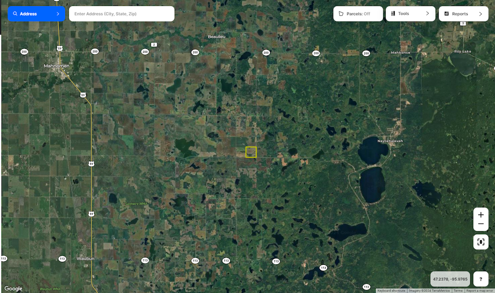
Mahnomen County
Prime Investment Opportunity In High-Quality Tillable Ground
TBD CSAH 6, Lot#WP001 Waubun, MN 56589


Description
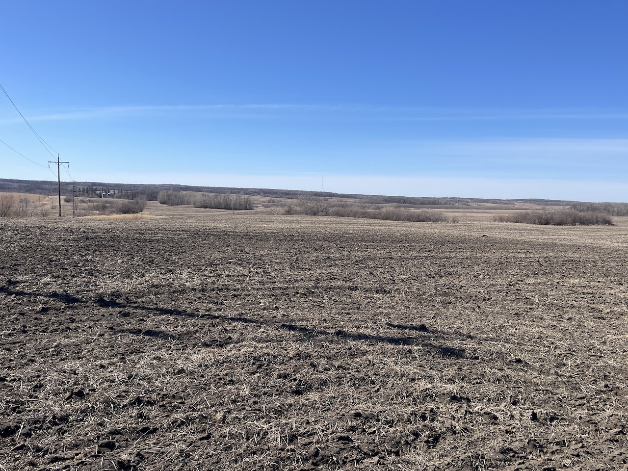
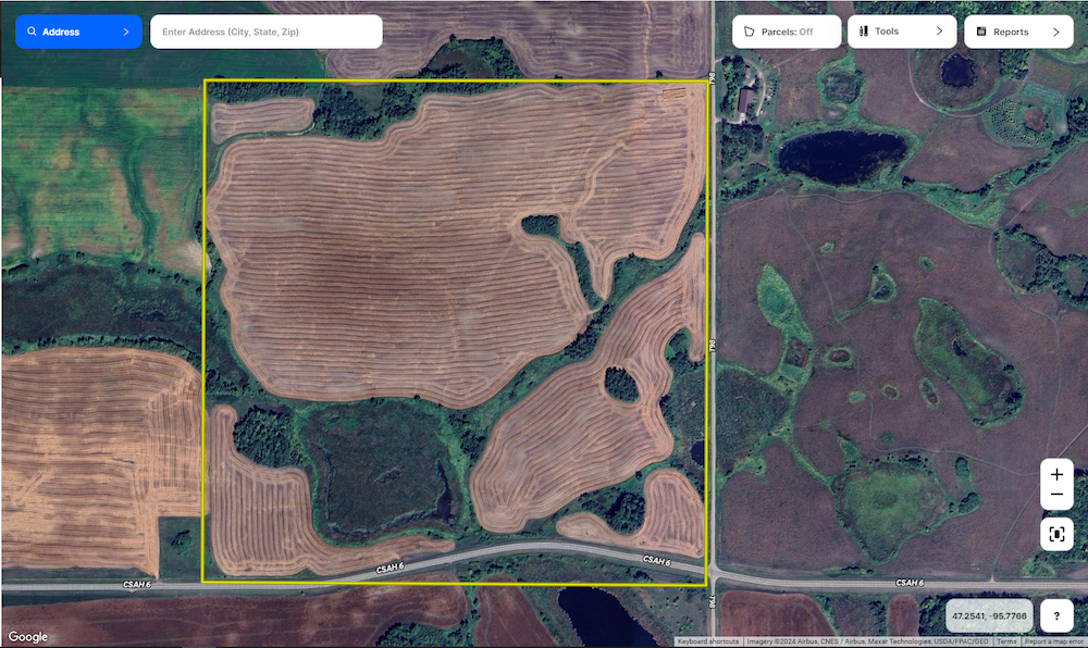
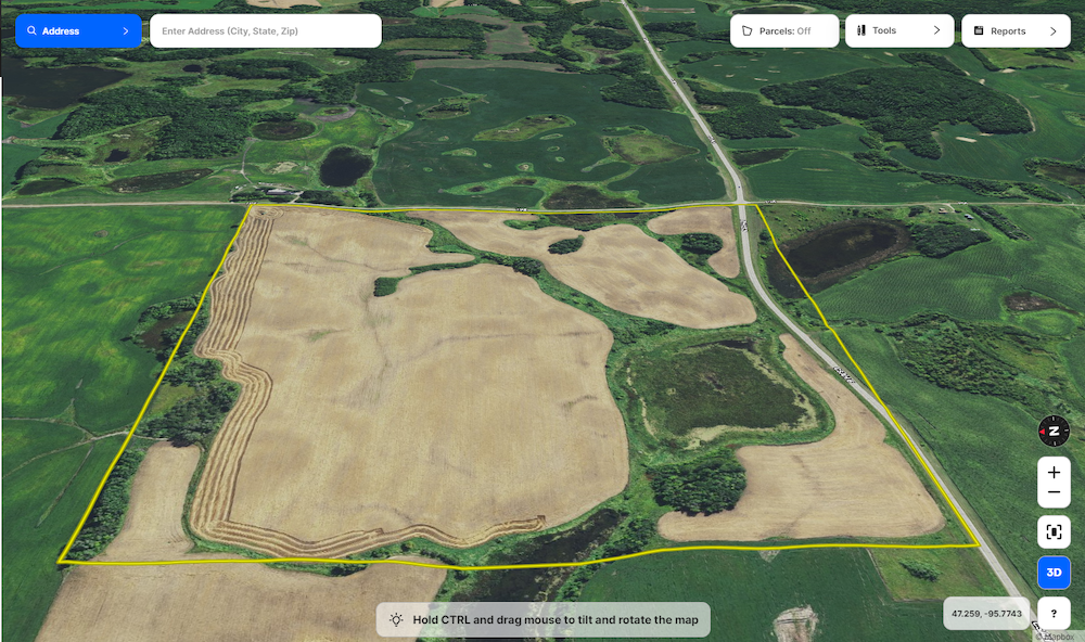
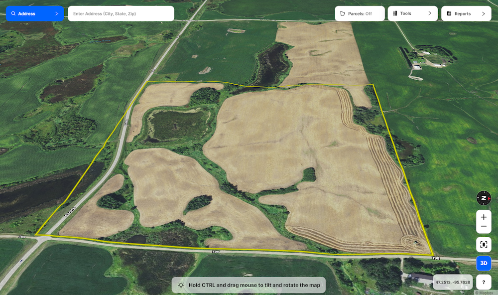
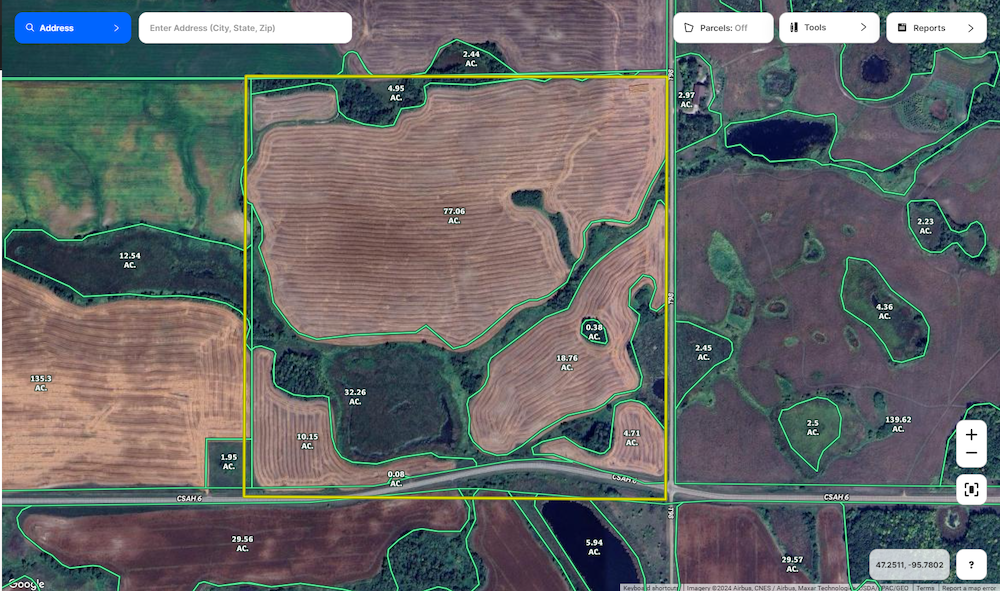
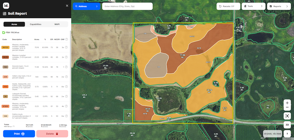
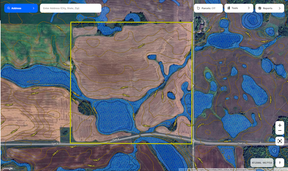
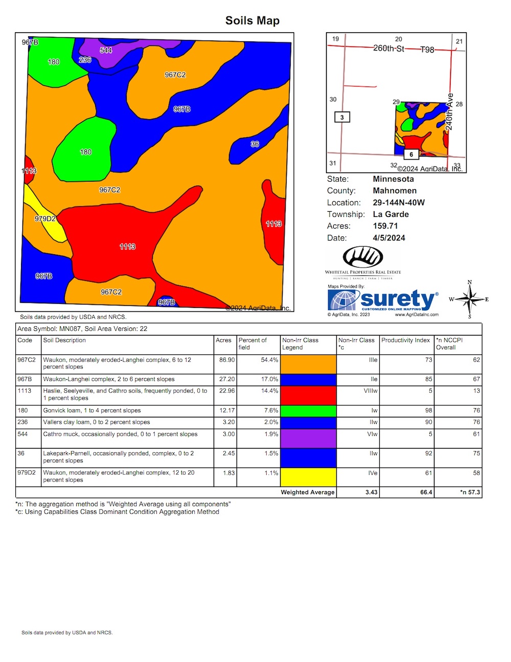
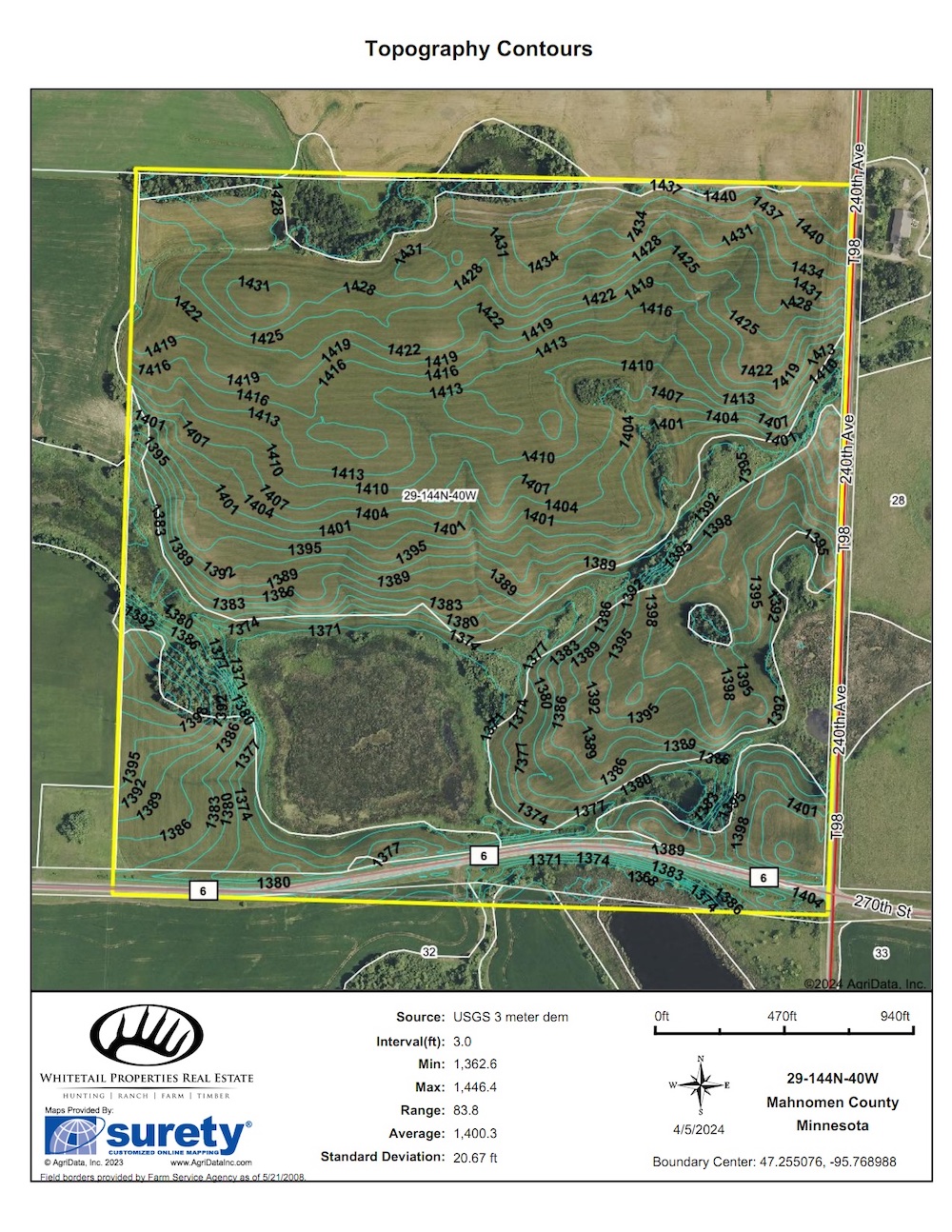
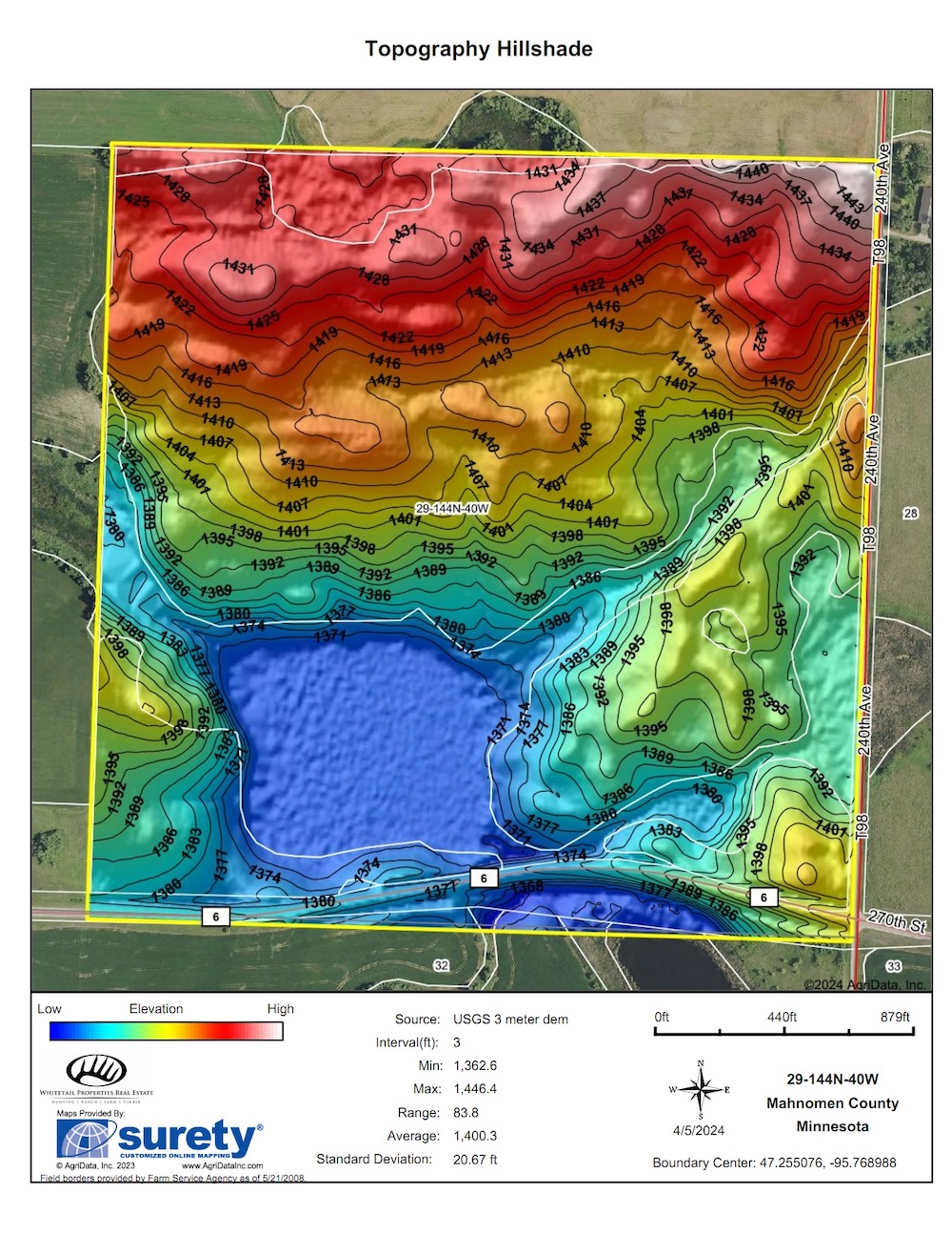
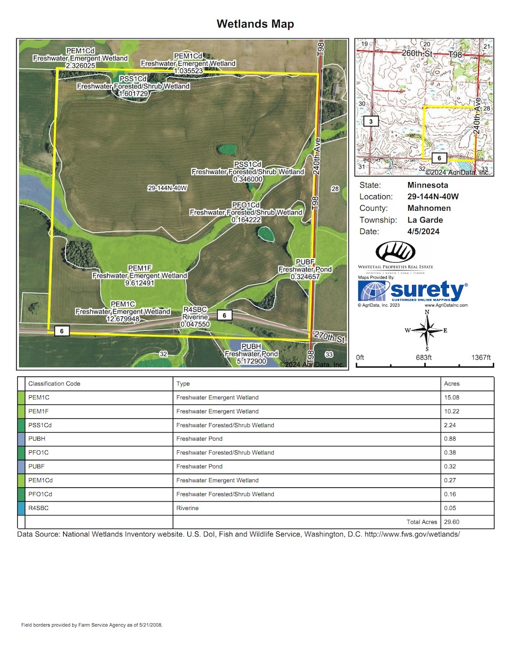
Here is a high-quality tract of Mahnomen County farmland located 12 miles southeast of Mahnomen in Section 29 of Lagarde Township. There are 110.3 FSA Tillable acres, with the remaining being wetland and wooded ground. The Crop Productivity Index (CPI) is 78.1, and the soils consist of Waukon sandy loam (64%), Waukon-Langhei complex (23%), and Gonvick loam (10%). The tillable acreage will be farmed by the current land owner for the 2024 growing season and will be available for open tenancy after the crops are harvested this fall. The property has been in wheat and soybeans rotation and will be planted in soybeans this year. This tract has multiple access points, from the paved county highway on the south line and the gravel township road on the east side of the property. It is near major grain markets and easily farmed with large equipment. This is a prime opportunity to expand your current production, make a sound investment in high-quality tillable land, or a great option for a 1031 exchange. This property has recreational aspects, with both open water ponds and thick brush/timber for hunting whitetail deer, waterfowl, and upland game.
Summary
Address
Nearby Features
Land Type
Property Type
Land and Farm Property Types
Road Frontage
Road Surface
Land Details
Improvements/Features
Activities on Property
Roads
Tillable/Production Areas
Waterfowl
Waterfront
Wild Game
Details
- Excellent investment opportunity for high quality tillable land
- 110+/- FSA tillable acres with 78.1 CPI
- Available for 2025 growing season
- Multiple access points and close to major grain markets
- Been in a wheat- beans rotation, will be planted in soybeans in 2024
- Easily accessible with large equipment
- Great option for a 10131 exchange or addition to ones current farm operation
- Potential building site with electricity road side
- Hunt whitetail deer, turkey, waterfowl, or pheasants
Other
Coordinates
Annual Taxes
Sold Property
For more information or to see additional properties currently for sale see Josh Miller's listings.