Broadwater County
Toston Duck Island On Missouri River
TBD Toston, MT 59642


Description
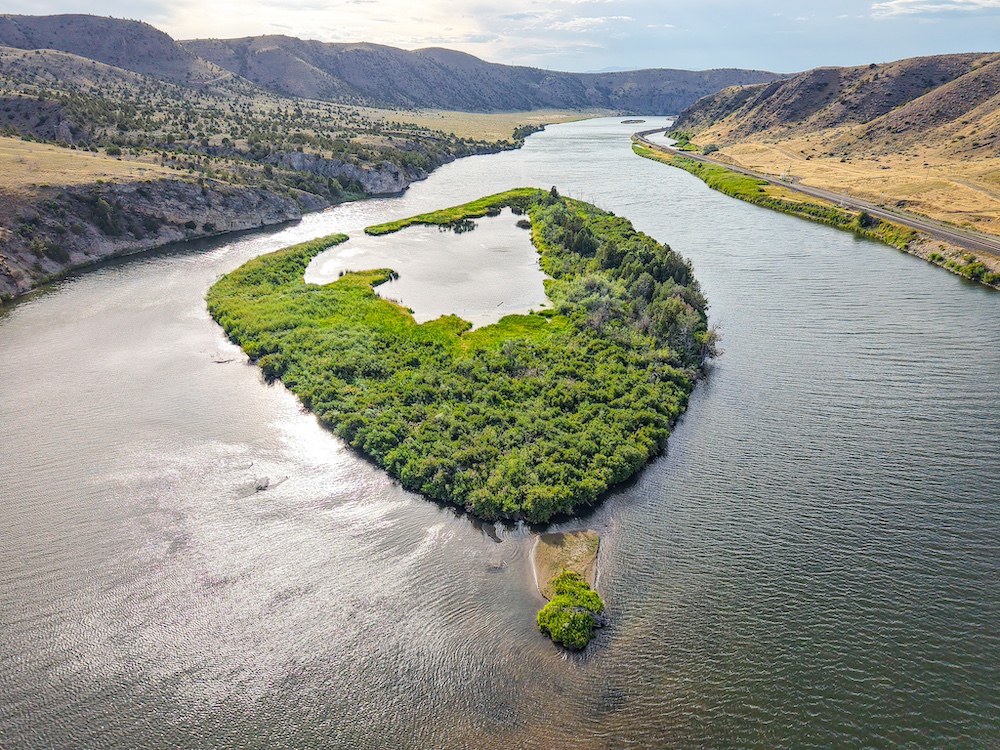
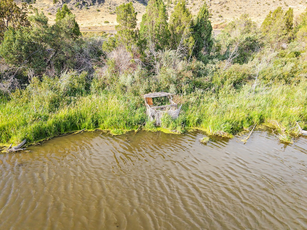
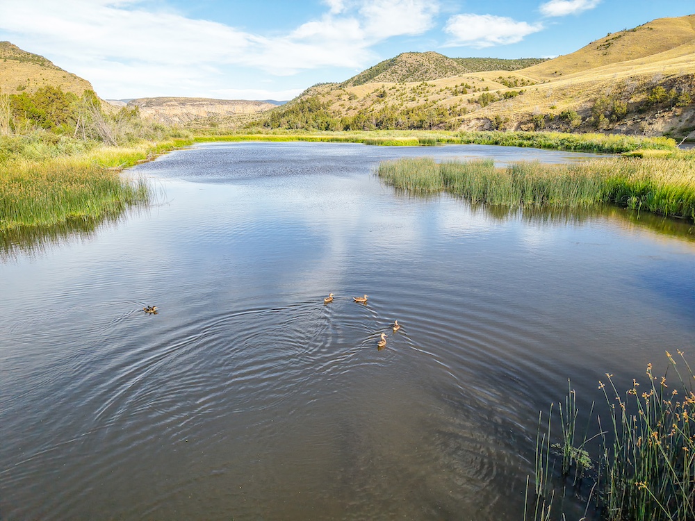
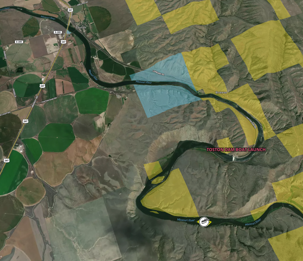
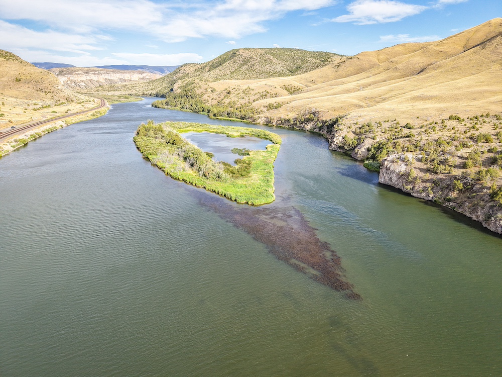
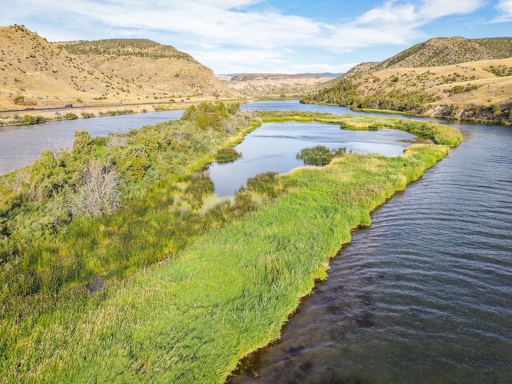
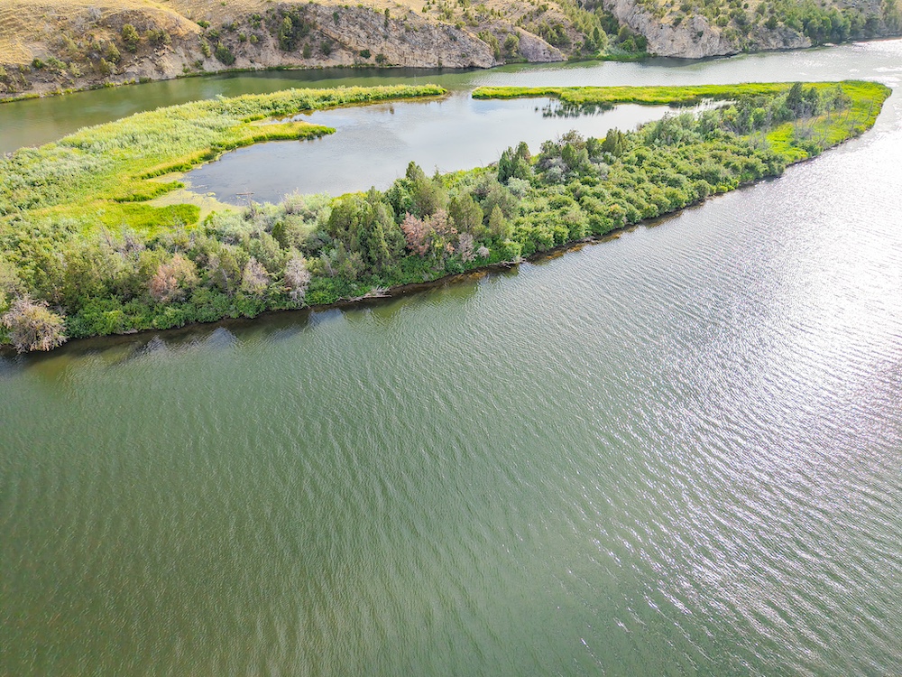
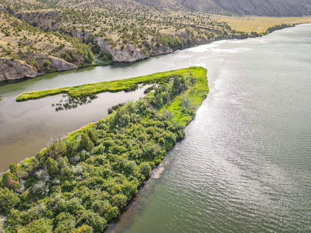
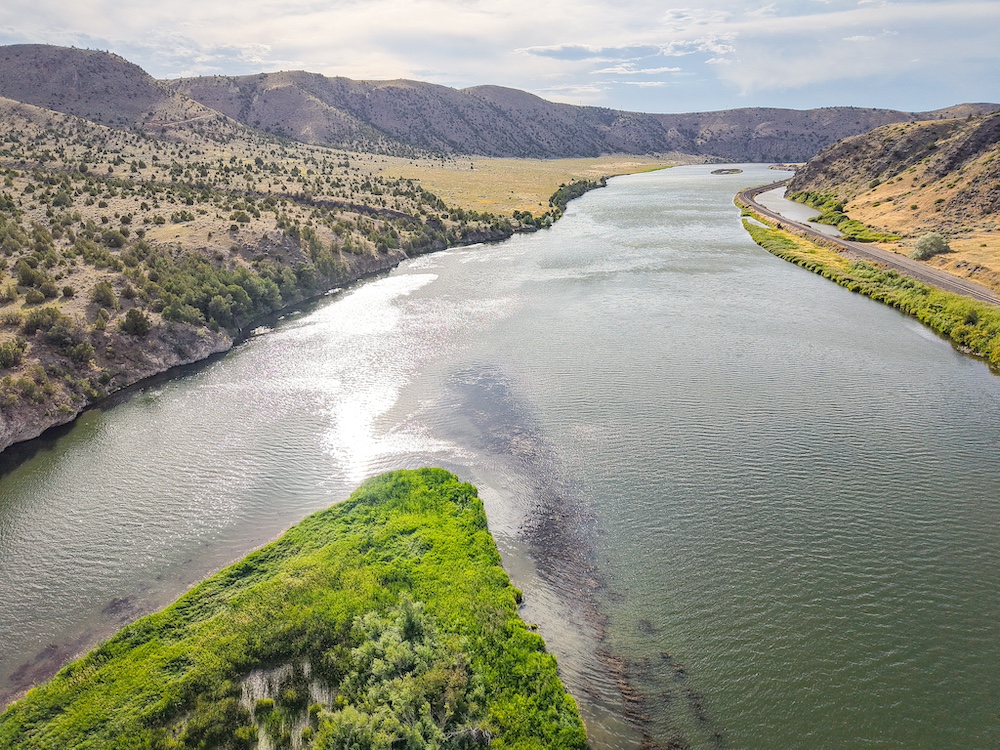
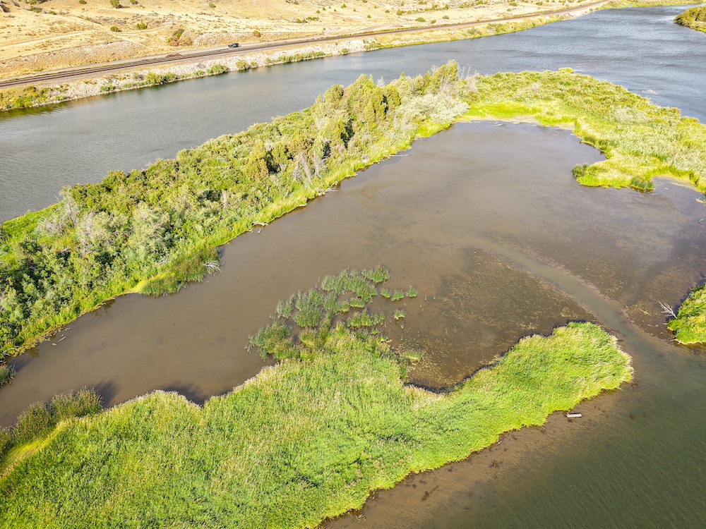
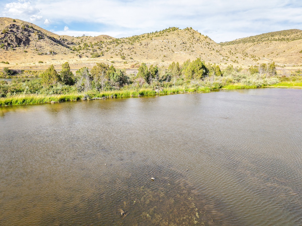
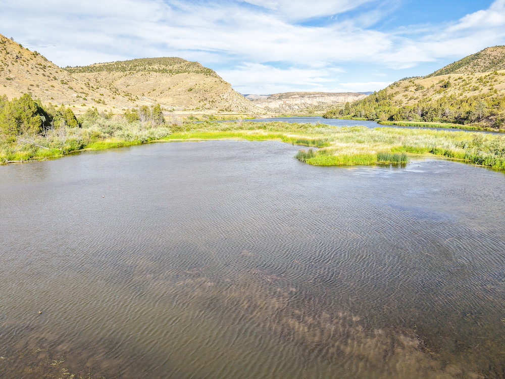
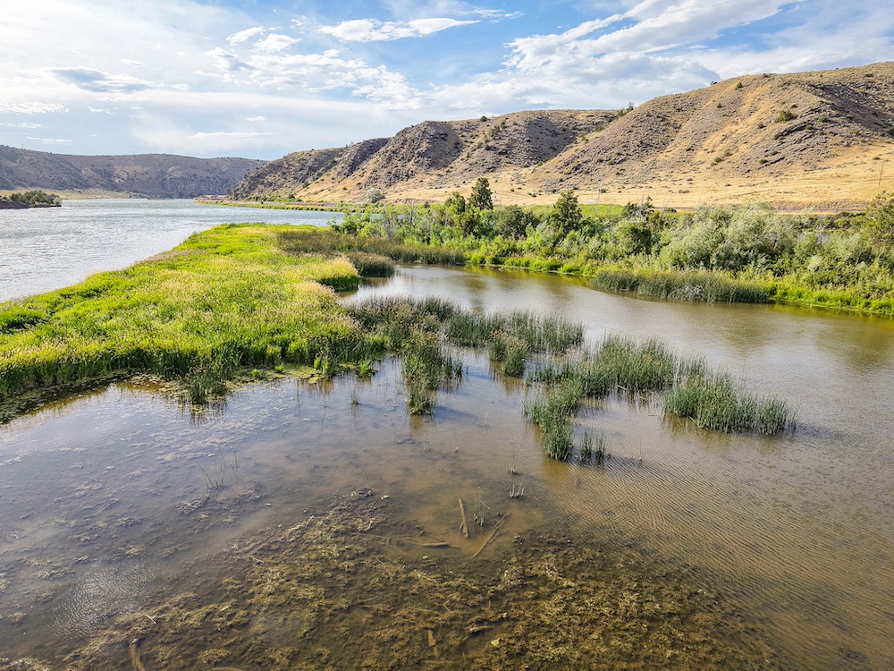
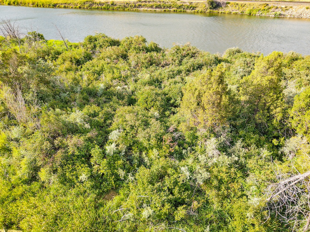
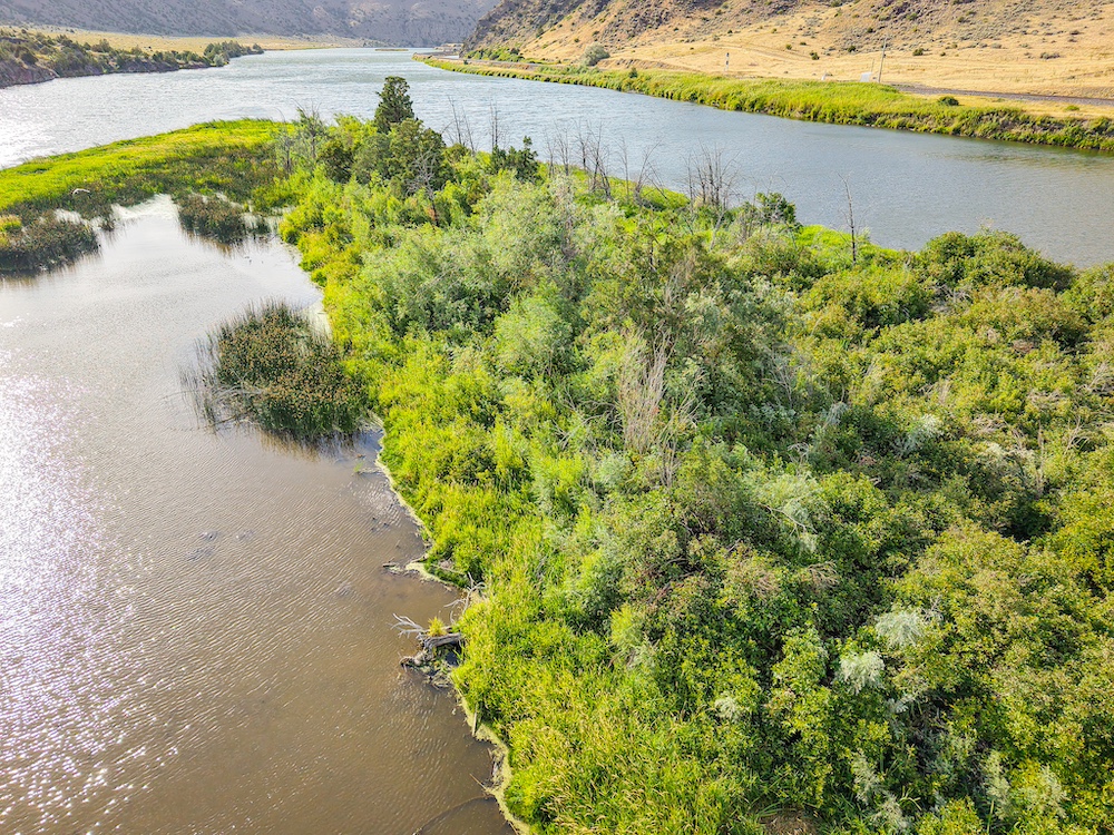
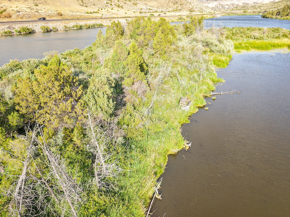
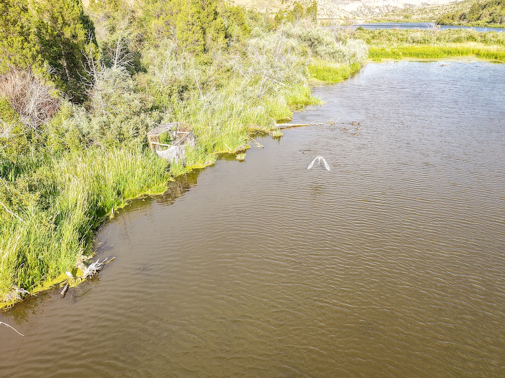
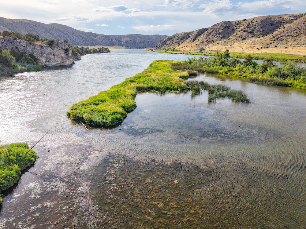
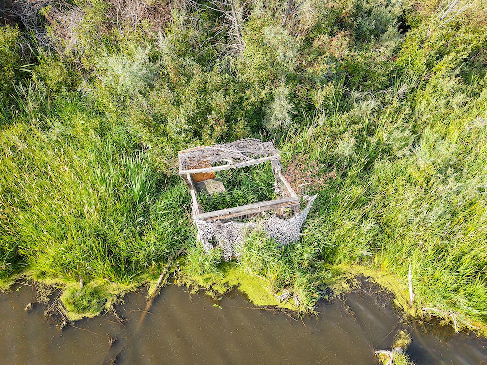
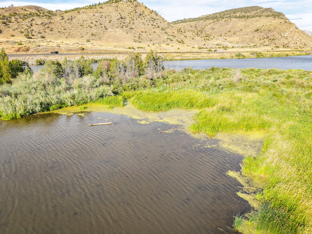
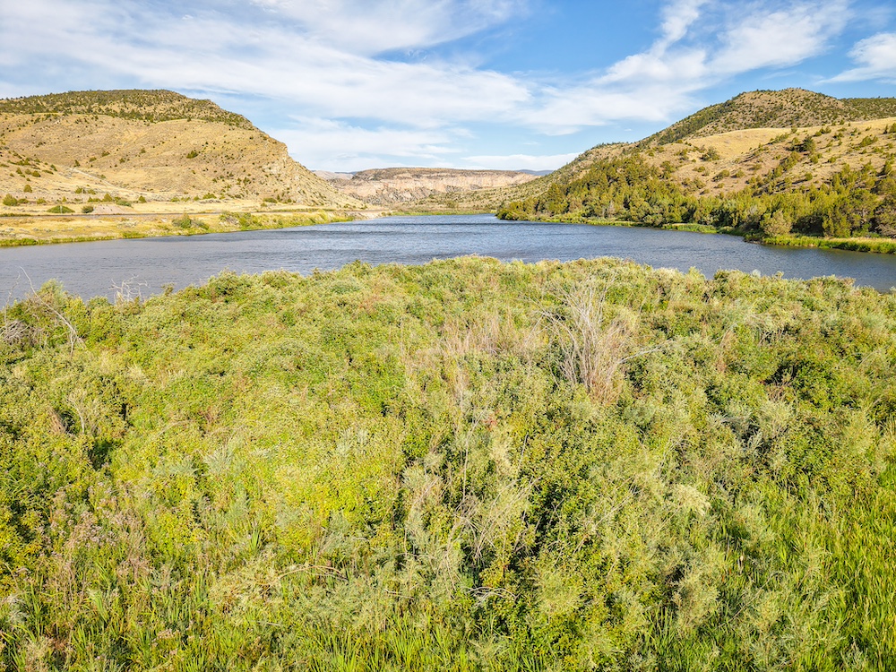
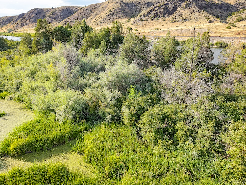
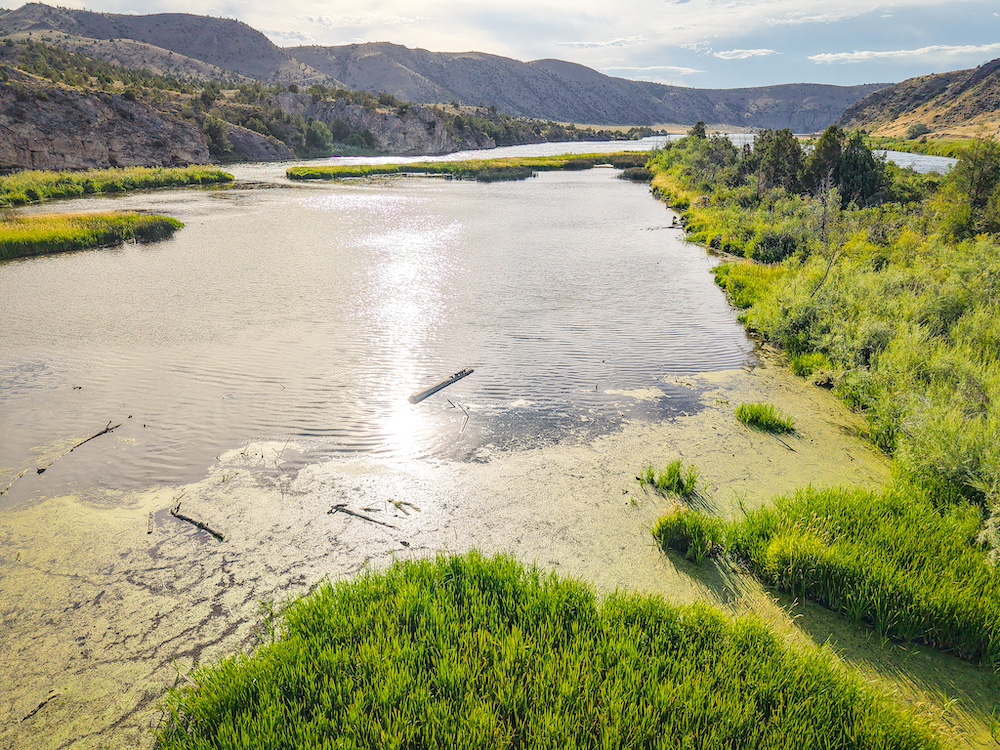
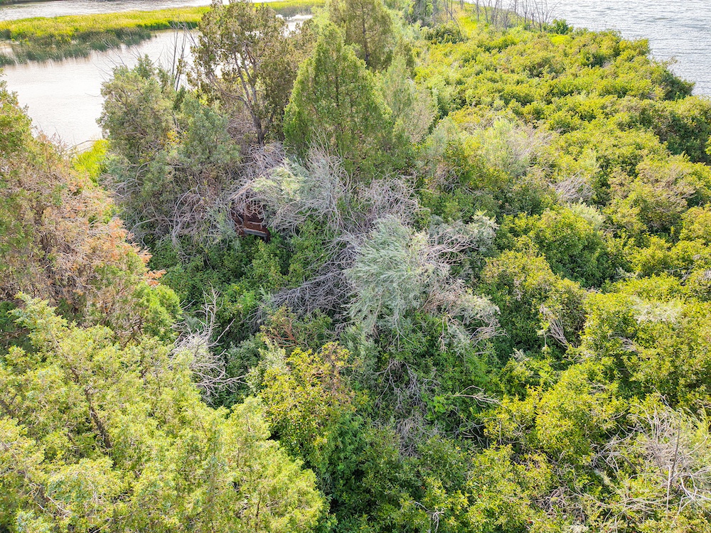
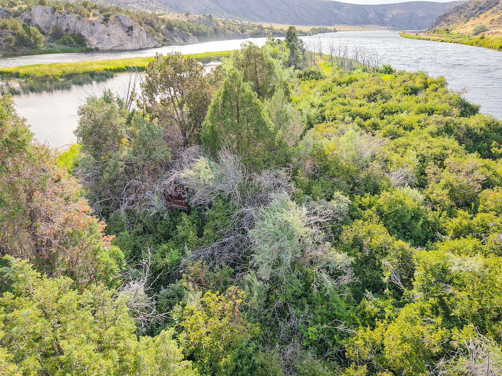
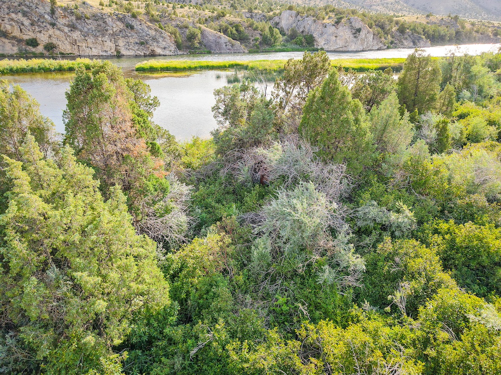
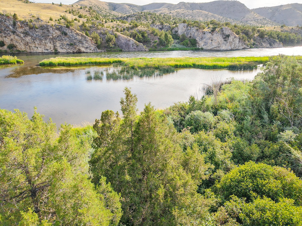
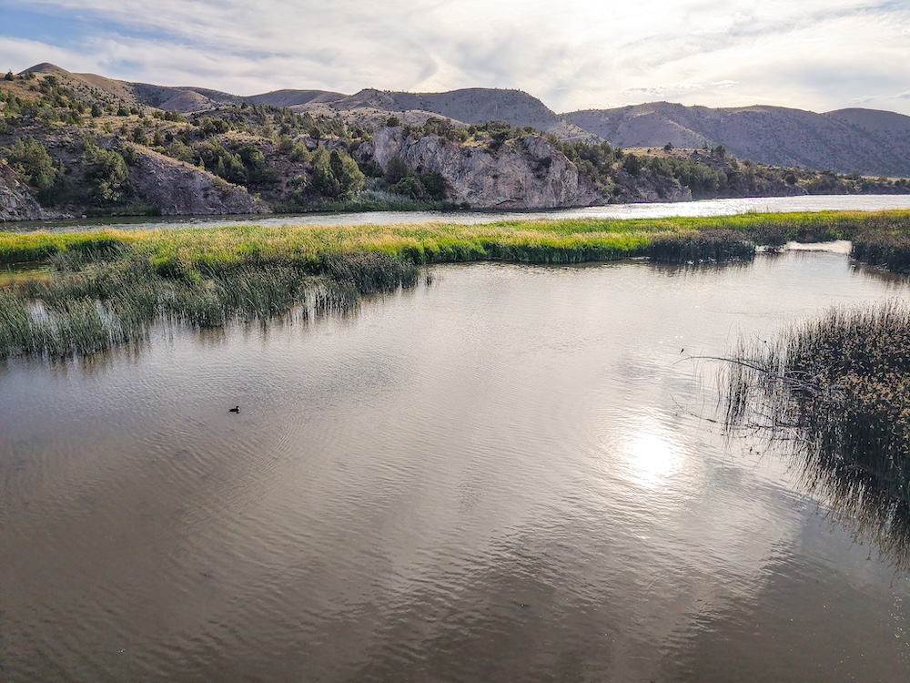
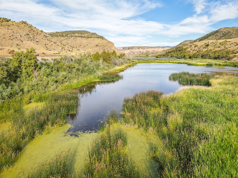
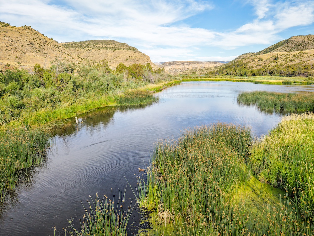
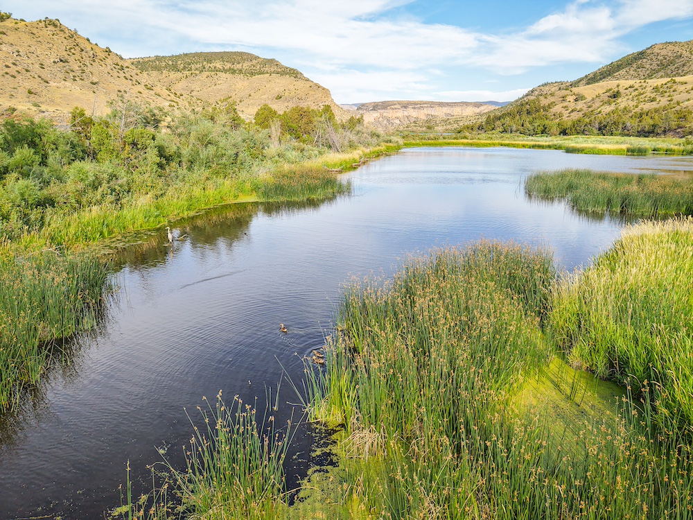
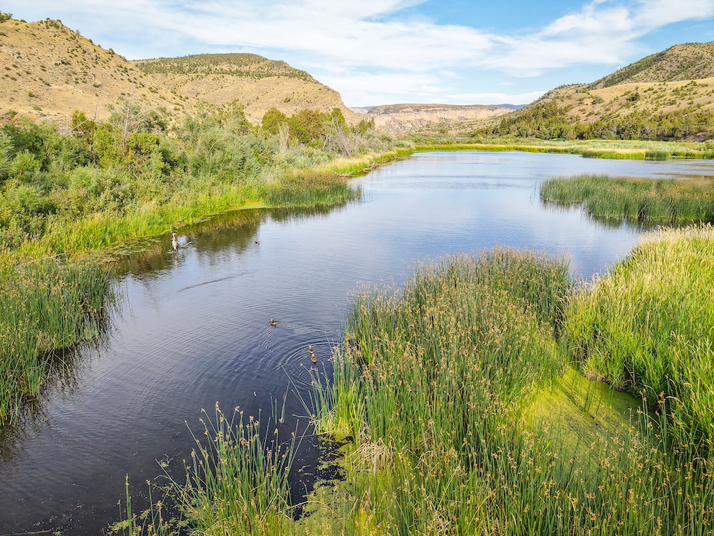
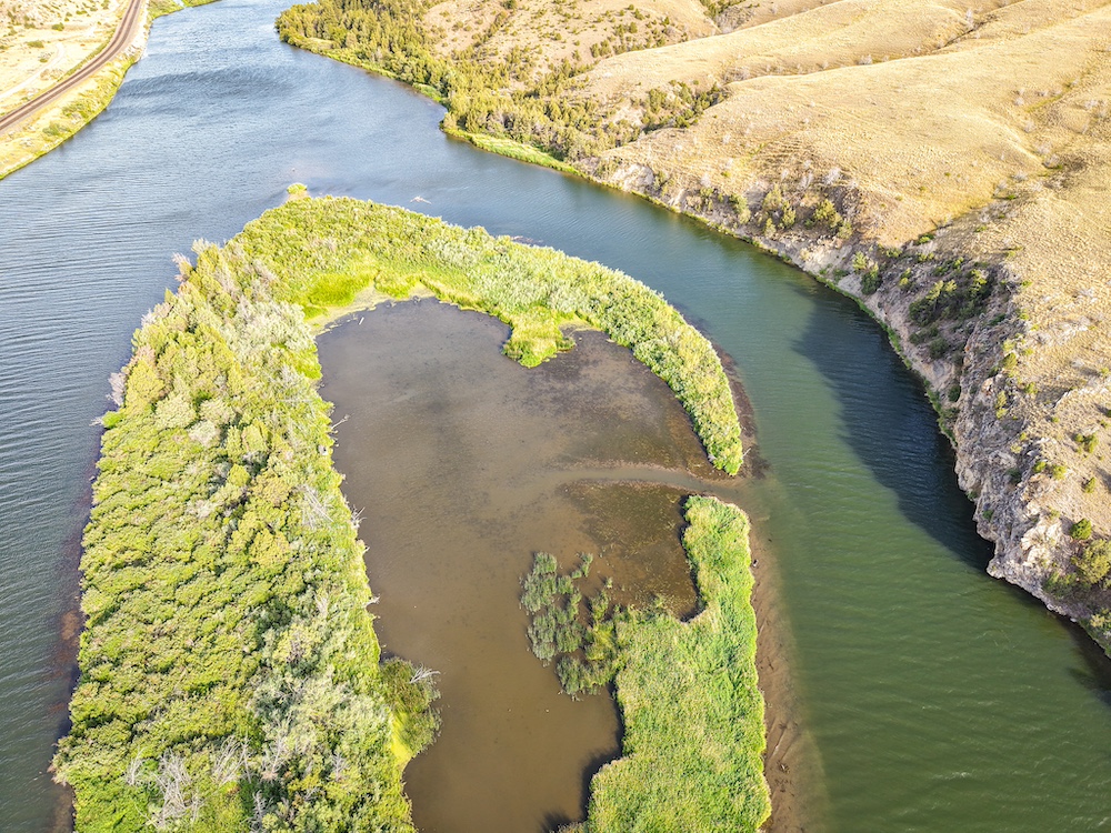
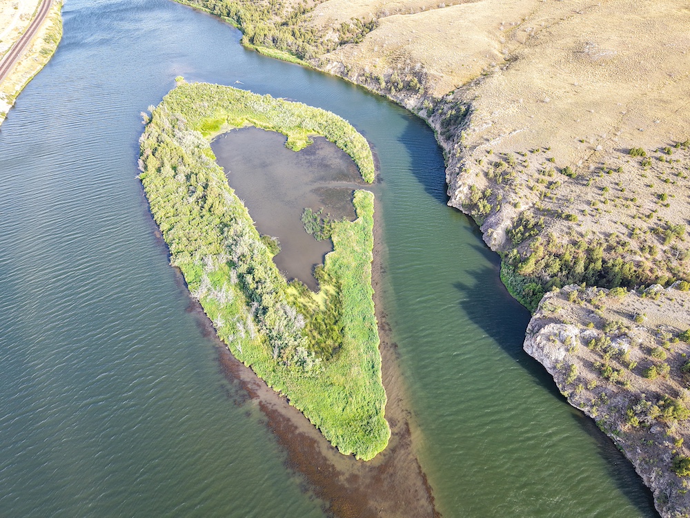
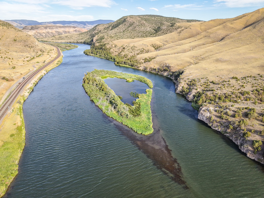
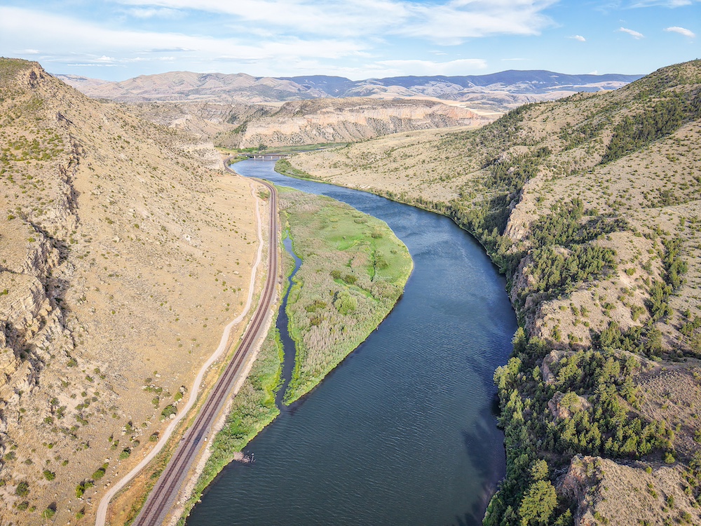
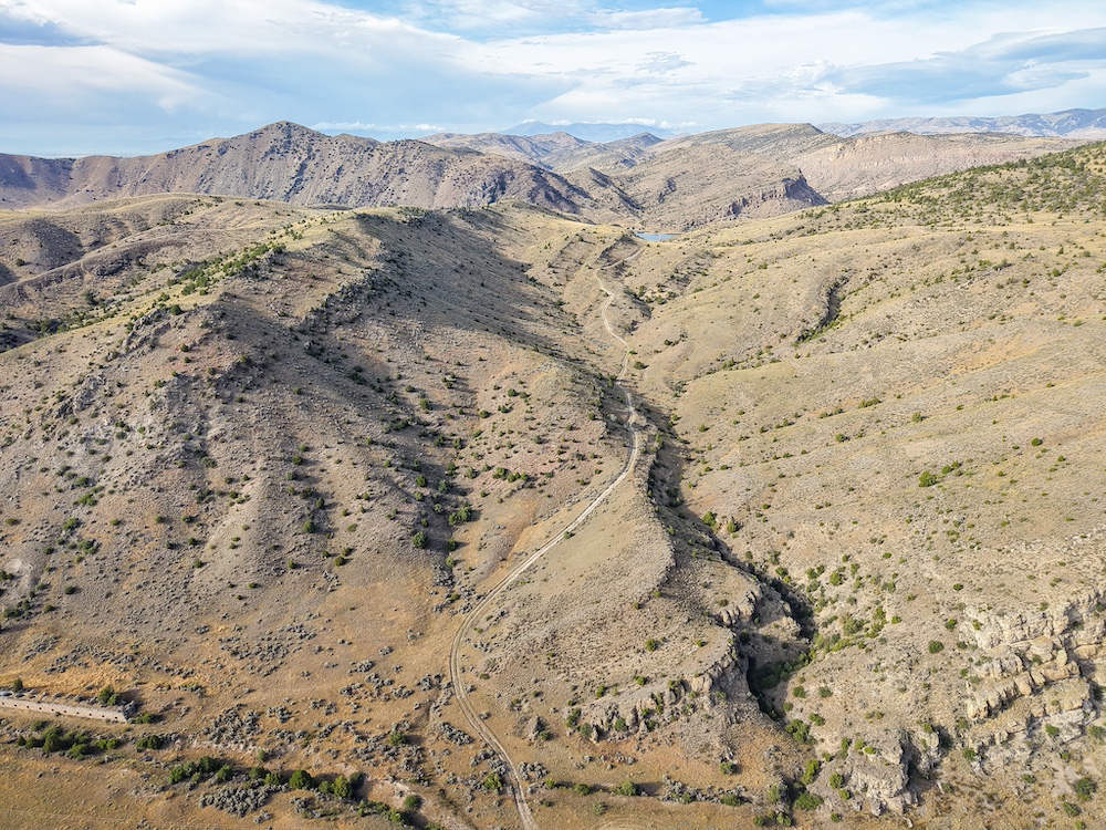
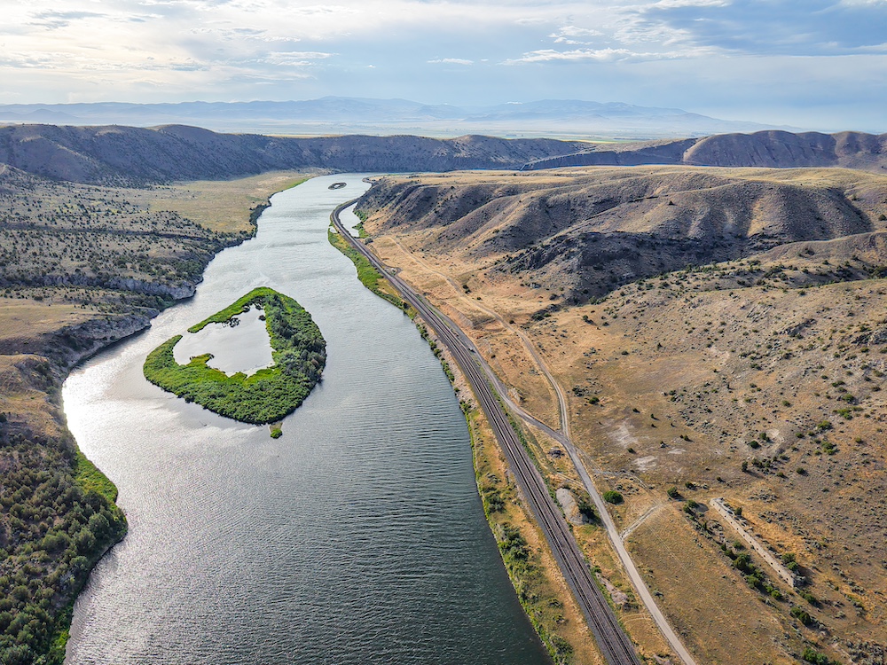
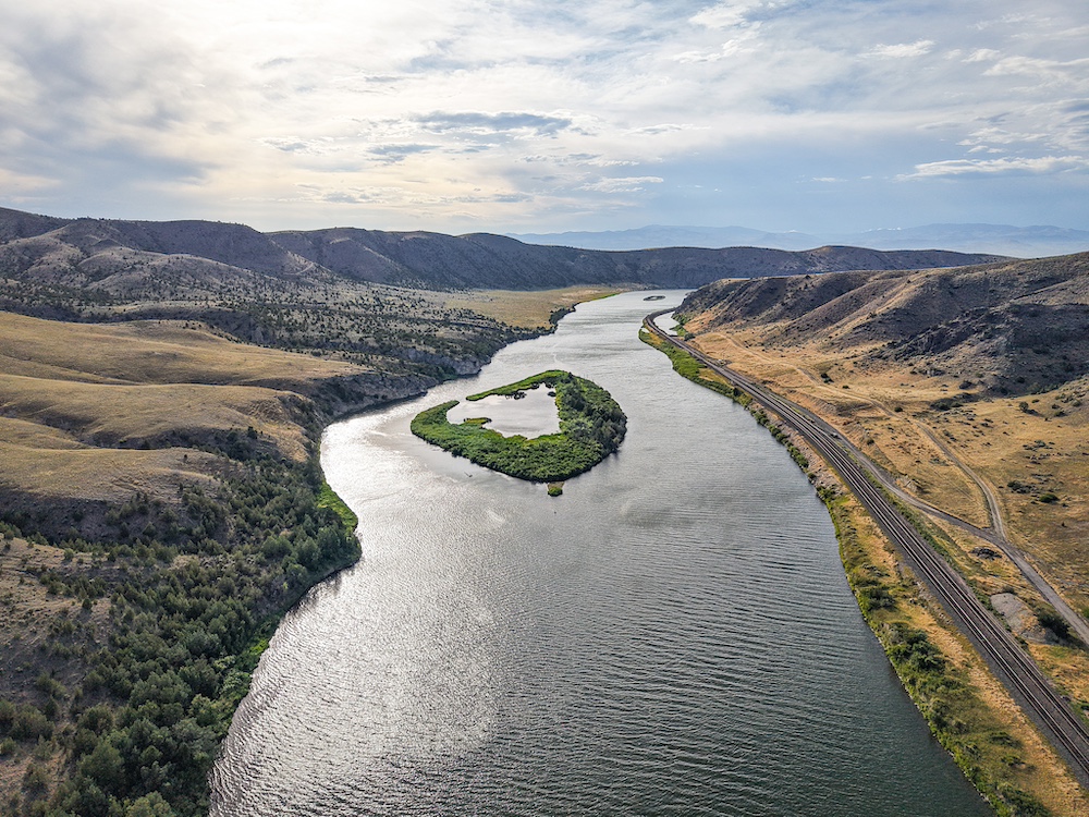
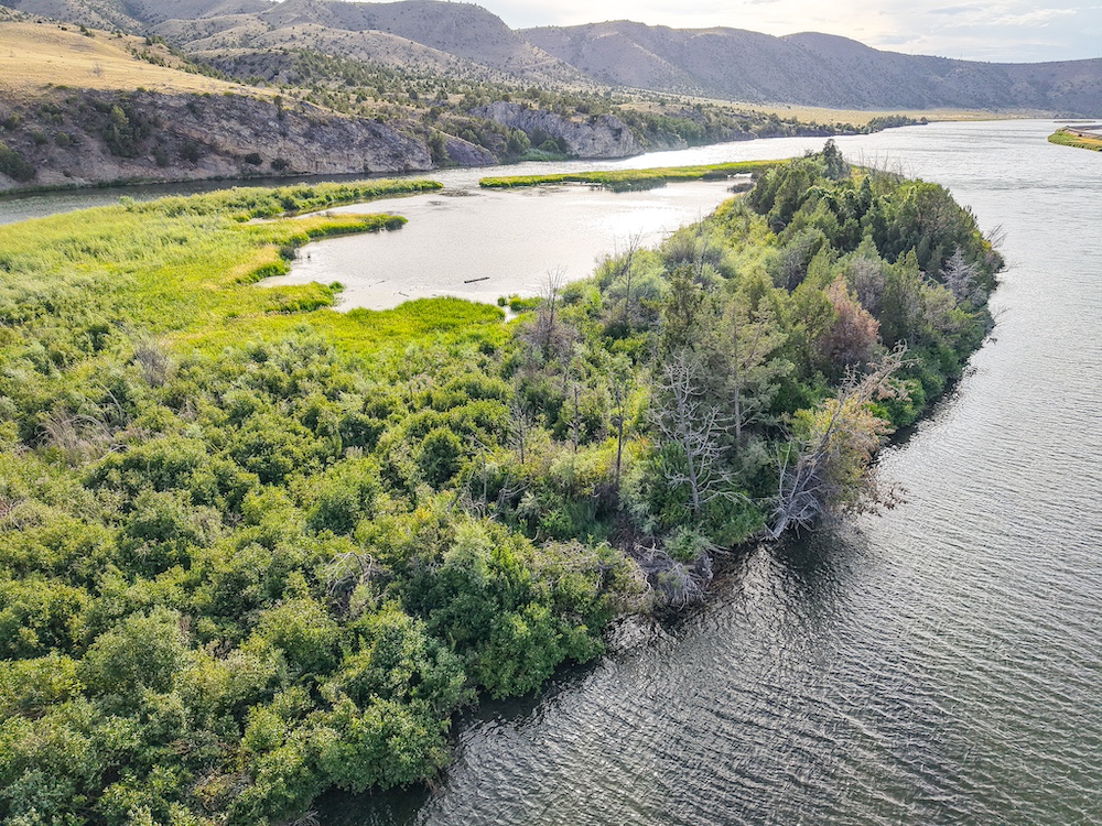
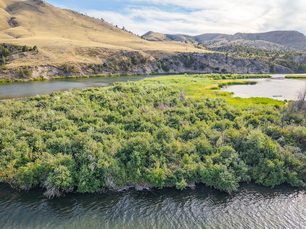
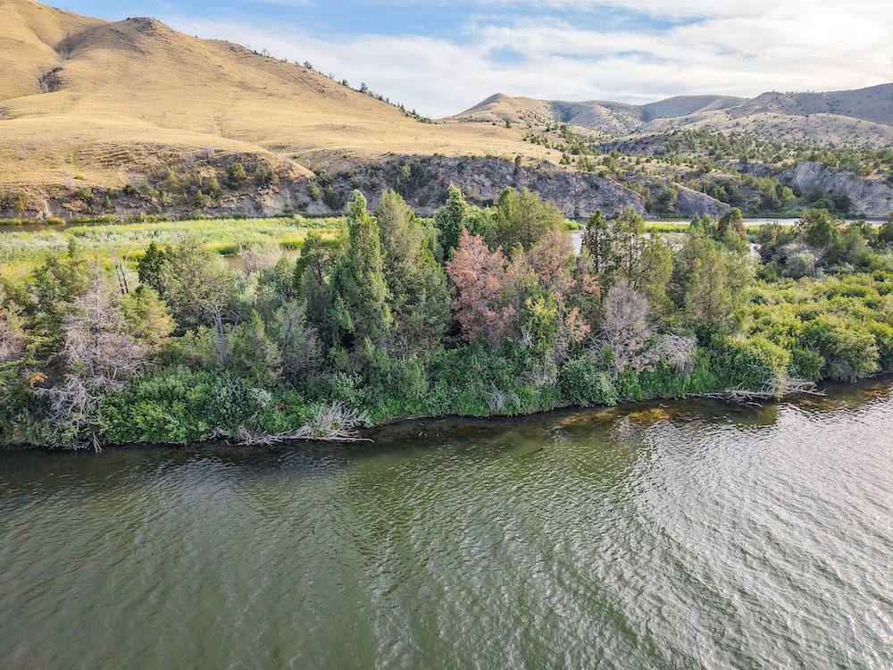
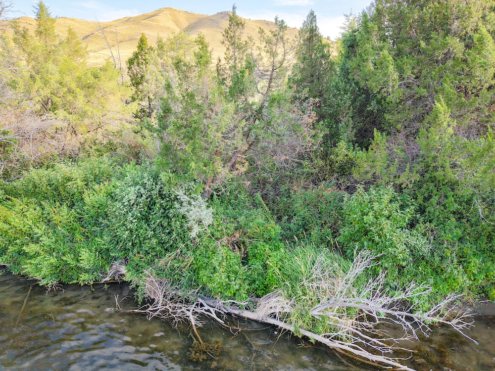
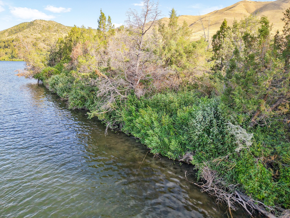
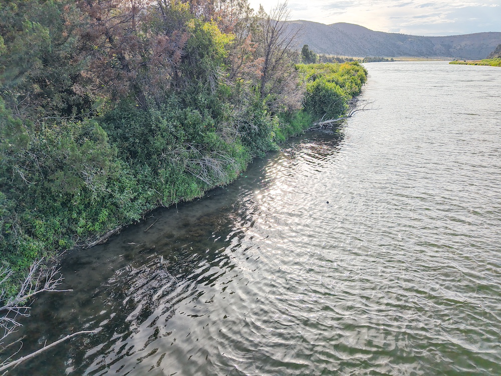
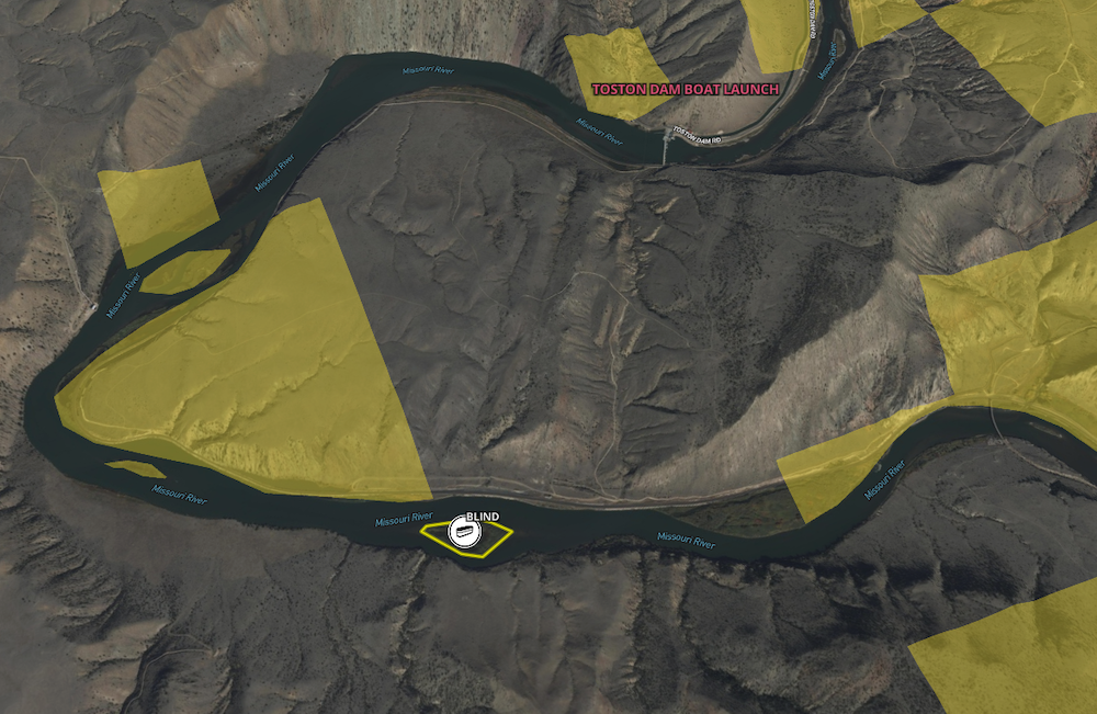
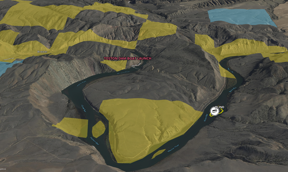
This unique property in Broadwater County, Montana, offers a rare opportunity to own a heavily vegetated island tract with significant waterfowl habitat and direct Missouri River access. Located approximately three river miles upstream of the Toston Dam and a public boat launch, the parcel is well-positioned for seasonal recreational use. Its shallow water cove, mature foliage, and established cover make it an attractive option for waterfowl hunters and wildlife observers. Remnants of an old duck blind can be seen within the island's shallow water cove telling a long forgotten story of past waterfall hunts on this unique offering. The island provides natural shelter and food sources for ducks, geese, and other species that frequent the Upper Missouri River Basin. Public lands on the adjacent riverbanks also provide additional boat/raft launch points and areas for outdoor activity and seasonal access to fishing, hunting, and hiking. The tract's heavy vegetation consists of native grasses, shrubs, and mature riparian trees that contribute to excellent concealment and habitat value. This same foliage creates a barrier of seclusion, ideal for recreation. Access is by boat or watercraft during appropriate seasons, as the parcel is surrounded by the flowing river channels. With private ownership of island properties becoming increasingly scarce in the Western U.S., this property stands out for its location and proximity to hubs like Bozeman and Helena. The land is undeveloped and lends itself well to low-impact recreational uses. This stretch of river is known for trout and walleye angling opportunities. Please note that the land has frequent flood potential, and the actual acreage is dependent on erosion and water levels. While the legal description says 12 acres, the land above the high water line is substantially less. Please see the links on the listing for Montana water law as it relates to navigable waters in the state.
Summary
Address
Nearby Features
Land Type
Property Type
Land and Farm Property Types
Land Details
Improvements/Features
Activities on Property
Fishing
Waterfront
Details
- Private island on Missouri River
- ~3 river miles upstream of Toston Dam
- Secluded water inlet for privacy and waterfowl hunting
- Lush grasses and riparian trees/foliage
- Flood plain, likely not suitable for permanent structure
- Trout and walleye opportunities
Area Links
Other
Coordinates
Annual Taxes
Sold Property
For more information or to see additional properties currently for sale see Ray Primmer's listings.