Upshur County
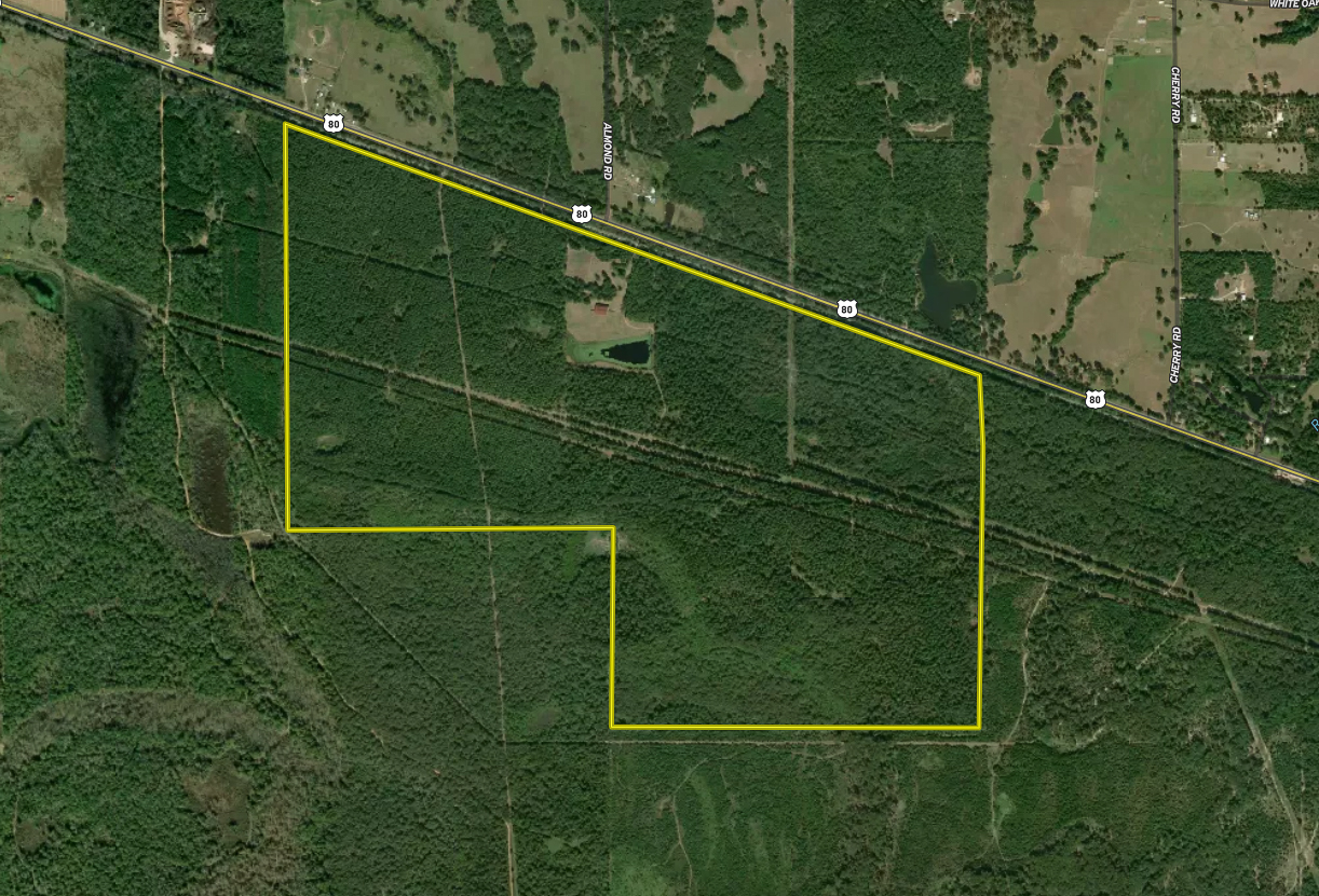
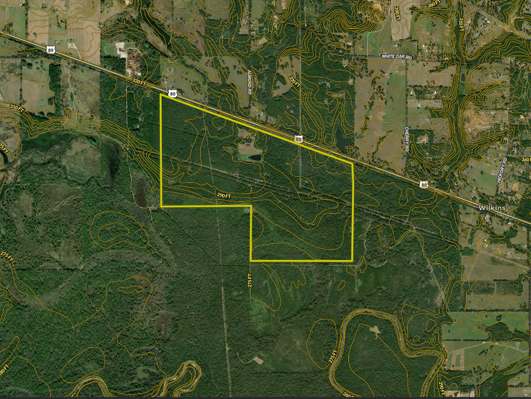
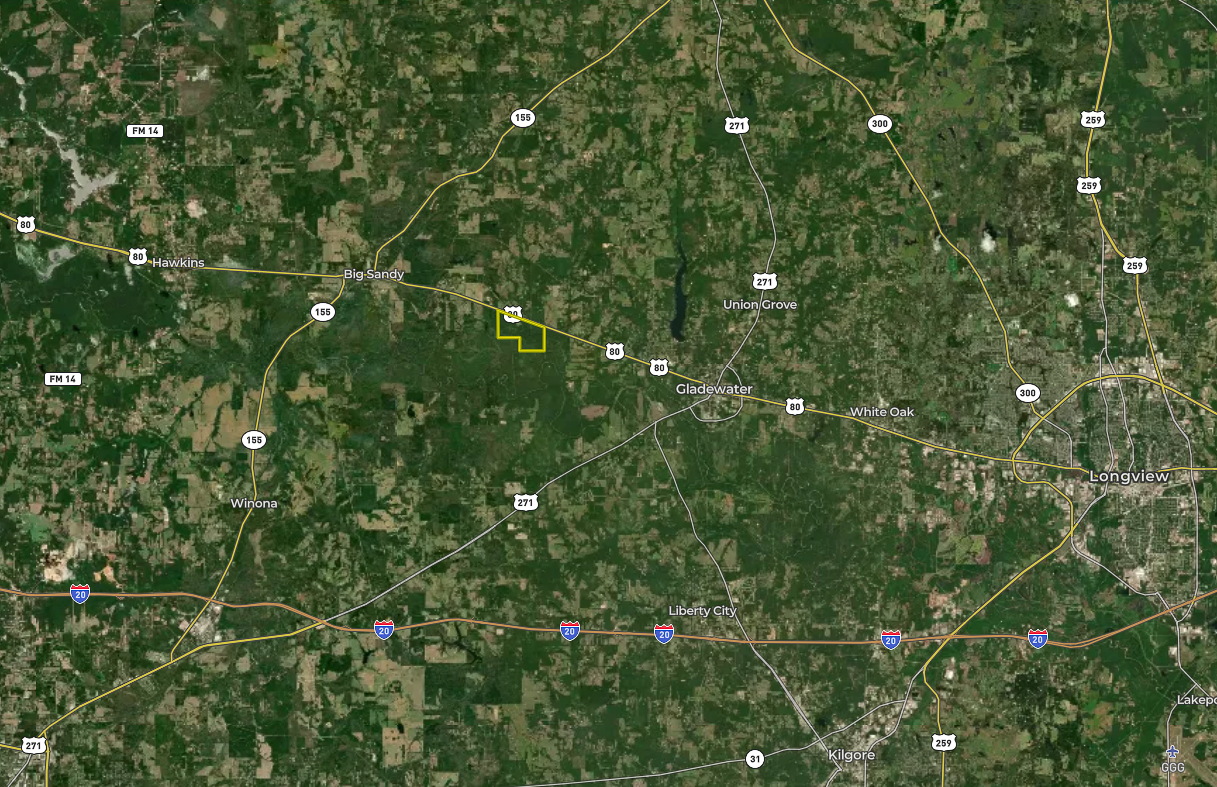
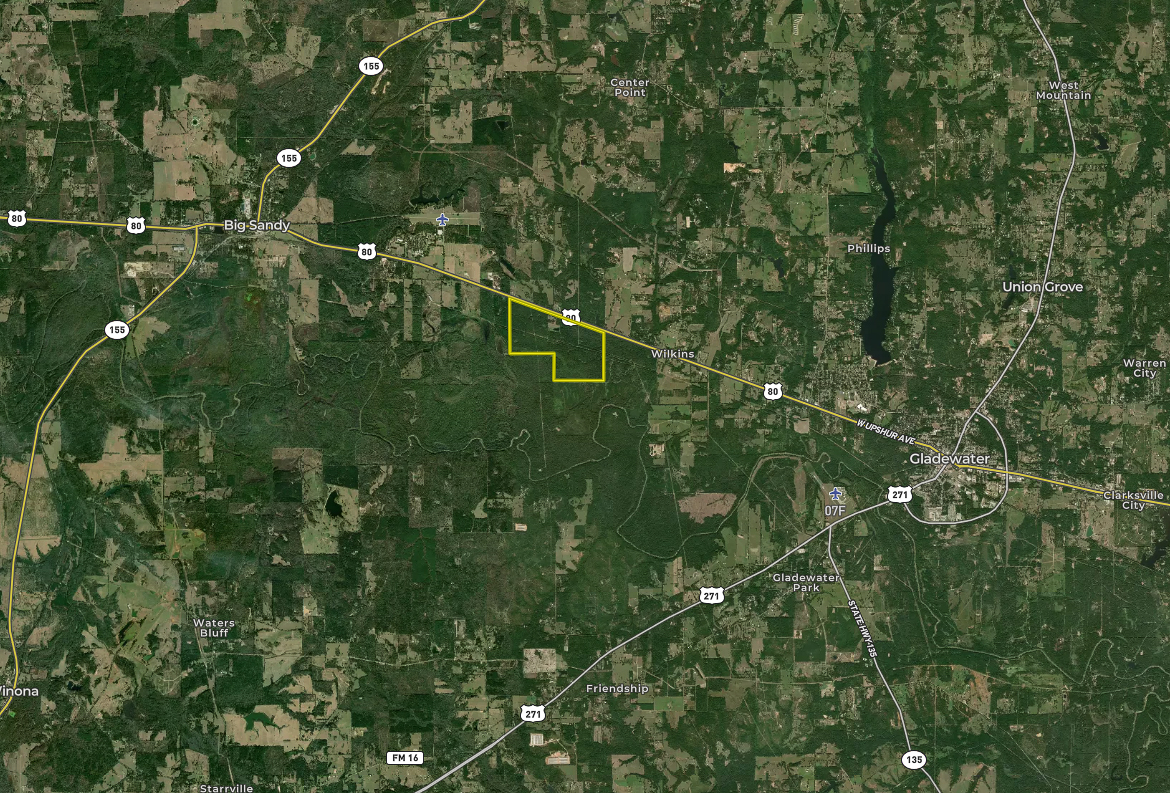
603 Acres Of Hunting Paradise In Upshur County
US Hwy 80 Big Sandy, TX 75755


Description
The Burnett Farm, spanning 603+/- acres in Upshur County, presents a remarkable opportunity for those seeking a pristine natural retreat. This hunting ranch boasts a lush and diverse landscape, featuring towering pine and mature hardwood forests, providing an unparalleled habitat for native wildlife such as deer, hogs, ducks, squirrels, and more. Situated within the serene Sabine River Bottom, this property is a wildlife haven. The idyllic 4+ acre lake, meandering live creek, and numerous sloughs offer a range of hunting and fishing experiences. Privacy is paramount, with extensive land tracts bordering the property, making it a sanctuary for both wildlife and peaceful enjoyment. Conveniently located just minutes from Gladewater, the antique capital of Texas, and with Dallas 98 miles to the West, Longview 15 miles to the East, and Tyler 18 miles SSW, The Burnett Farm offers a unique and accessible escape. Whether you're interested in recreational hunting or simply seeking a tranquil natural sanctuary, this ranch is a rare find.
Summary
Address
Land Type
Property Type
Land and Farm Property Types
Road Surface
Fencing
Outbuildings
Land Details
Improvements/Features
Road Frontage
Activities on Property
Roads
Nearby Features
Fishing
Tillable/Production Areas
Waterfowl
Waterfront
Wild Game
Recent Property Improvements
Minerals
Details
- Diverse timber landscape featuring pine and various hardwoods
- Rich biodiveristy, making it haven for native wildlife including deer, hogs, squirrels, ducks, etc...
- Established 4.25 acre lake with a covered pier providing fishing and water fowl hunting opportunities
- Duck sloughs provide ample waterfowl habitat along with Little White Oak Creek that runs through the property
- Large land tracts on multiple sides provide wildlife habitat protection and user privacy
Other
Utilities
Coordinates
Annual Taxes
Sold Property
For more information or to see additional properties currently for sale see Aaron Porter's listings.